
Page 82 - Introduction to Mineral Exploration
P. 82
4: RECONNAISSANCE EXPLORATION 65
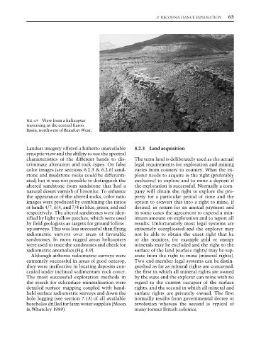
FIG. 4.9 View from a helicopter
traversing in the central Karoo
Basin, northwest of Beaufort West.
Landsat imagery offered a hitherto unavailable 4.2.3 Land acquisition
synoptic view and the ability to use the spectral
characteristics of the different bands to dis- The term land is deliberately used as the actual
criminate alteration and rock types. On false legal requirements for exploration and mining
color images (see sections 6.2.3 & 6.2.6) sand- varies from country to country. What the ex-
stone and mudstone rocks could be differenti- plorer needs to acquire is the right (preferably
ated, but it was not possible to distinguish the exclusive) to explore and to mine a deposit if
altered sandstone from sandstone that had a the exploration is successful. Normally a com-
natural desert varnish of limonite. To enhance pany will obtain the right to explore the pro-
the appearance of the altered rocks, color ratio perty for a particular period of time and the
images were produced by combining the ratios option to convert this into a right to mine, if
of bands 4/7, 6/4, and 7/4 in blue, green, and red desired, in return for an annual payment and
respectively. The altered sandstones were iden- in some cases the agreement to expend a min-
tified by light yellow patches, which were used imum amount on exploration and to report all
by field geologists as targets for ground follow- results. Unfortunately most legal systems are
up surveys. This was less successful than flying extremely complicated and the explorer may
radiometric surveys over areas of favorable not be able to obtain the exact right that he
sandstones. In more rugged areas helicopters or she requires, for example gold or energy
were used to trace the sandstones and check for minerals may be excluded and the right to the
radiometric anomalies (Fig. 4.9). surface of the land (surface rights) may be sep-
Although airborne radiometric surveys were arate from the right to mine (mineral rights).
extremely successful in areas of good outcrop, Two end-member legal systems can be distin-
they were ineffective in locating deposits con- guished as far as mineral rights are concerned:
cealed under inclined sedimentary rock cover. the first in which all mineral rights are owned
The most successful exploration methods in by the state and the explorer can mine with no
the search for subsurface mineralisation were regard to the current occupier of the surface
detailed surface mapping coupled with hand- rights, and the second in which all mineral and
held surface radiometric surveys and down the surface rights are privately owned. The first
hole logging (see section 7.13) of all available normally results from governmental decree or
boreholes drilled for farm water supplies (Moon revolution whereas the second is typical of
& Whateley 1989). many former British colonies.