
Page 17 - An Atlas of Carboniferous Basin Evolution in Northern England
P. 17
10
Chapter
2
also cite the obliquity of thrust transport directions to the Variscan Front to have similar geometries to major border faults in areas of active extension such
suggest a component of dextral displacement. as the Aegean and Basin and Range (e.g. Jackson 1987; Stein & Barientos
1985) (see following sections).
Superimposed on the NW-SE trend are two further structural trends,
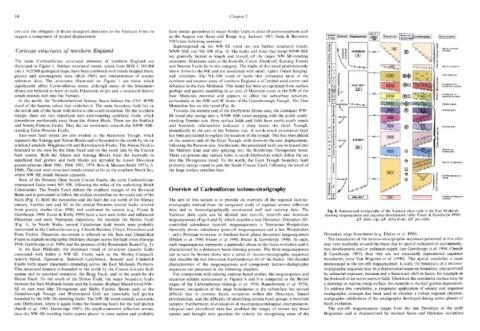
Variscan structures of northern England NNW-SSE and NE-SW (Fig. 1). The faults and folds that trend NNW-SSE
are generally limited in length and branch off the major NW-SE-trending
The main Carboniferous structural elements of northern England are structures. Structures such as the Ironville, Calow, Hardstoft, Eakring-Foston
illustrated in Figure 1. Surface structural trends, taken from BGS 1 :500 000 and Nocton Faults lie in this category. The faults of this trend predominantly
and 1 : 625 000 geological maps, have been combined with trends mapped from, throw down-to-the-NE and are associated with small, tightly folded hanging-
gravity and aeromagnetic data (BGS 1965) and interpretation of seismic wall anticlines. The NE-SW trend of faults that dominates most of the
reflection data. The structures illustrated on Figure 1 are those which northern and western areas of northern England is of limited areal extent and
significantly affect Carboniferous strata, although many of the lineaments influence in the East Midlands. This trend has been extrapolated from surface
shown are believed to have an early Palaeozoic origin and a structural history geology and gravity modelling in an area of Mesozoic cover in the NW of the
which extends well into the Tertiary. East Midlands province and appears to affect the subsurface structure,
In the north, the Northumberland-Solway Basin follows the ENE-WSW particularly at the NW and SE limits of the Gainsborough Trough. The Don
trend of the lapetus suture that underlies it. The main boundary fault lies on Monocline lies on this trend (Fig. 4).
the north side of the basin with down-to-the-south extension. On the southern Towards the western end of the Derbyshire Dome area, the dominant NW-
margin there are two important east-west-trending antithetic faults which SE trend also swings into a NNW-SSE trend merging with the north-south-
downthrow northwards away from the Alston Block. These are the Stublick trending Pennine axis. Here surface folds and folds have north-south trends
and Ninety-Fathom Faults. They die out westwards towards the NNW-SSE- and borehole information indicates a deep basin, the Goyt Trough,
trending Eden-Pennine Faults. immediately to the east of the Pennine axis. A north-south extensional fault
East-west fault trends are also evident in the Stainmore Trough, which has been postulated to explain the location of the trough. This has been placed
separates the Askrigg and Alston Blocks and is bounded to the north by the en on the western side of the Goyt Trough, with down-to-the-east displacement,
echelon Lunedale, Wigglesworth and Butterknowle Faults. The Alston Block is following the Pennine axis. Southwards, the postulated fault can be traced into
bounded to the west by the Dent Fault and on the south side by the Craven the Malvern Line and also splaying into the Boothorpe-Thringstone trend.
fault system. Both the Alston and Askrigg Blocks form the footwalls to There are present-day surface folds in south Derbyshire which define the arc
significant half graben and both blocks are intruded by Lower Devonian into the Thringstone trend. To the north, the Goyt Trough boundary fault
granite plutons (Bott 1961, 1964, 1967, 1974; Bott & Masson-Smith \951a, b, probably swings round to join the South Craven Fault, following the trend of
1960). The east-west structural trends extend as far as the southern North Sea, the large surface anticline here.
where NW-SE trends become apparent.
West of the Pennine-Dent-South Craven Faults, the early Carboniferous
extensional faults trend NE-SW, following the strike of the underlying Welsh
Caledonides. The Pendle Fault defines the southern margin of the Bowland Overview of Carboniferous tectono-stratigraphy
Basin and is postulated to follow the surface monocline on the south side of the
basin (Fig. 1). Both the monocline and the fault die out north of the Mersey The aim of this section is to provide an overview of the regional tectono-
estuary. Further east and SE in the central Pennines several faults inferred stratigraphy derived from the integrated study of regional seismic reflection
from gravity studies (Lee 1988) and confirmed by seismic (e.g. Fraser & data tied to biostratigraphically constrained well and outcrop data. The Fig. 8. Summarized stratigraphy of the Variscan plate cycle in the East Midlands
Gawthorpe 1990; Evans & Kirby 1999) have a east-west strike and influenced Variscan plate cycle can be divided into syn-rift, post-rift and inversion showing megasequence and sequence development (after Fraser & Gawthorpe 1990).
Dinantian and early Namurian deposition, for example the Holme Fault megasequences (Figs 8 and 9), which describe a late Devonian-Dinantian rift- AT, delta top; AF, delta front; AP, pro delta.
(Fig. 1). In North Wales, several Caledonian fault trends were probably controlled subsidence (syn-rift megasequence), a Namurian-Westphalian
reactivated in the Carboniferous (e.g. Church Stretton, Clwyd, Pontesford and thermally driven subsidence (post-rift megasequence) and a late Westphalian
Prees Faults). Dinantian movement is inferred on the Bala and Llanelidian - early Permian inversion or foreland-basin phase (inversion megasequence) Dinantian stage boundaries (e.g. Ebdon et a!. 1990).
Faults to explain stratigraphic thickness changes across the fault zones (George (Ebdon et al. 1990; Fraser et al. 1990; Fraser & Gawthorpe 1990). As such, The boundaries of the tectono-stratigraphic sequences presented in this atlas
1958; Gawthorpe et al. 1989) and the presence of the Rossendale Basin (Fig. 1). each megasequence represents a particular phase in the basin evolution and is may vary markedly around the basin due to spatial variations in accommoda-
In the East Midlands, the dominant trend of structures (usually faults characterized by a dominant basin-forming process. The three megasequences tion development and/or sediment supply (see Gawthorpe et al. 1994; Church
associated with folds) is NW-SE. Faults such as the Morley-Campsall, can in turn be broken down into a series of tectono-stratigraphic sequences & Gawthorpe 1997), thus they are not necessarily depositional sequence
Askern-Spital, Egmanton, Bakewell-Ladybrook, Bonsall and Cinderhill that describe the late Devonian-Carboniferous fill of the basins. The detailed boundaries sensu Van Wagoner et al. (1990). This spatial variability is most
Faults form major lineaments extending across the East Midlands Platform. characteristics of the megasequences and component tectono-stratigraphic pronounced in the syn-rift megasequence. Locally the boundary of a tectono-
This structural domain is bounded to the north by the Craven-Lincoln fault sequences are presented in the following chapters. stratigraphic sequence may be a depositional sequence boundary, characterized
system and its eastward extension, the Brigg Fault, and to the south by the For comparison with existing outcrop-based studies, the megasequence and by subaerial exposure, incision and a basinward shift in facies, for example in
Hoton Fault. To the south of the Hoton Fault, the major boundary faults sequence scheme summarised in Figures 8 and 9 is compared to the British the footwall of an active normal fault. Elsewhere the correlative surface may be
between the East Midlands basins and the London-Brabant Massif trend NW- stages of the Carboniferous (George et al. 1976; Ramsbottom et al. 1978). a downlap or marine onlap surface, for example in the half graben depocentre.
SE to east-west (the Thringstone and Sileby Faults). Basins such as the However, recognition of the stage boundaries in the subsurface has proved To address this variability, a pragmatic application of seismic and sequence
Gainsborough Trough and Widmerpool Gulf are essentially half graben difficult due to extreme facies variations within the Dinantian, faunal stratigraphic concepts has been used to develop a robust regional chronos-
bounded by the NW-SE-trending faults. The NW-SE trend extends westwards provincialism, and the difficulty of identifying certain fossil groups in borehole tratigraphic subdivision of the stratigraphy developed during active phases of
into Derbyshire, where it again forms the bounding faults for the half graben samples. Furthermore, re-evaluation of macropalaeontological, micropalaeon- basin evolution.
(Smith et al. 1985; Gutteridge 1987). On depth-converted reflection seismic tological and microfloral data has modified the ranges of certain key fossil The syn-rift megasequence ranges from the late Devonian to the early
data the NW-SE-trending faults appear planar in cross section and probably species and brought into question the criteria for recognising some of the Brigantian and is characterized by marked facies and thickness variations