
Page 22 - An Atlas of Carboniferous Basin Evolution in Northern England
P. 22
Chapter 3
Carboniferous basin development
The Carboniferous basin development of northern England is illustrated in a Widmerpool Gulf sequence thickens into the Hoton Fault and ultimately the Thringstone-Sileby
series of regional seismic lines presented in this chapter. Each of the major syn- Fault, which was the major basin-bounding fault at this time and lies to the SW
rift basins will be described in turn, using representative seismic lines (Fig. 10) The Widmerpool Gulf is typical of the many fault-bounded Carboniferous of Figure 12 (see Figs 1 and 45). The base shows a suggestion of progressive
that have been tied to well and outcrop control. In addition to the seismic data, basins of northern England forming the southern of two main depocentres that northwards onlap onto the pre-rift megasequence in the hanging-wall. The top
depth converted geological interpretations for each of the seismic lines are comprise the East Midlands province (Figs 1 and 11). It is bounded to the of the sequence is marked by a high-amplitude, laterally continuous reflector.
presented to illustrate the development of these tectono-stratigraphic sequences south by the Hoton Fault, the major basin-bounding fault, and to the north by Internally the sequence is characterized by low-amplitude, high-frequency,
across the province. Particular attention is paid to the Widmerpool Gulf the Cinderhill Fault, a major antithetic fault (Figs 1 and 11). The Hathern Shelf laterally discontinuous events (Fig. 12).
because the combination of seismic quality, well penetrations and the presence and the East Midlands Platform form the respective footwalls of these faults.
of exposure of the syn-rift along-strike in Derbyshire allows us to discuss the The geometry of the Widmerpool Gulf is that of a strongly asymmetric graben Fades and bio stratigraphy. Sequence ECl has not been penetrated by boreholes
tectono-stratigraphic sequences in detail. that was inverted along its southern bounding fault in the late Carboniferous in the Widmerpool Gulf.
The depth converted geological interpretations are based on corrected sonic (Fig. 12).
logs taken from nearby boreholes, where available. Elsewhere, and for the The seismo-stratigraphic scheme proposed for the Widmerpool Gulf, and Interpretation. The marked thickening of the ECl sequence into the major
deeper Dinantian section on most lines, seismic stacking velocities have been applied throughout this chapter, was introduced by Fraser et al. (1990) and basin-bounding faults (the Hoton and Thringstone-Sileby Faults) indicates
applied. The errors inherent in this latter method could result in errors in the further developed by Fraser & Gawthorpe (1990) and Ebdon et al. (1990) (Figs that deposition occurred during a phase of extension and normal faulting. This
depth section of as much as ±10%. Typical velocities used in the depth 8, 9 and 13). The scheme is based on the integration of approximately 200 km early phase of faulting represents the initial development of the half graben.
conversion of the Eakring and Welton sections in the East Midlands and the of high-quality, multifold seismic reflection data, well data (from which Downlapping alluvial fans, similar to those penetrated in the hanging-wall of
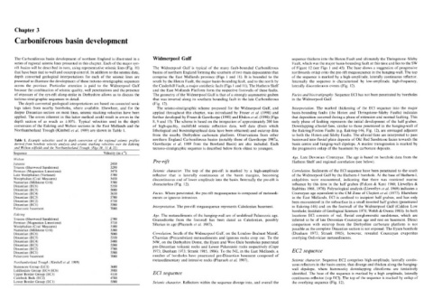
Northumberland Trough (Kimbell et al. 1989) are shown in Table 1. lithological and biostratigraphical data have been obtained) and outcrop data the Eakring/Foston Faults (e.g. Eakring-146, Fig. 12), are envisaged adjacent
from the nearby Derbyshire carbonate platform. Observations from other to both the Hoton and Sileby Faults. The alluvial fans are interpreted to pass
Table 1. Example velocities used in depth conversion of the regional seismic profiles northern England Carboniferous basins (notably those of Gawthorpe 1987a, basinward into fluvial plain deposits of Old Red Sandstone facies towards the
derived from borehole velocity analysis and seismic stacking velocities over the Eakring Gawthorpe et al. 1989 from the Rowland Basin) are also included. Each basin centre and hanging-wall dipslope. A marine transgression is marked by
and Welton oilfields and the Northumberland Trough (Figs 10, 11 & 22) tectono-stratigraphic sequence is described below from oldest to youngest. the progressive onlap of the basement by carbonate deposits.
1
Sequence Velocity (m s' )
Age. Late Devonian-Courceyan. The age is based on borehole data from the
Welton
Jurassic 2450 Pre-rifftt Hathern Shelf and regional correlation (see below).
Triassic (Sherwood Sandstone) 3290
Permian (Magnesian Limestone) 3470 Seismic character. The top of the pre-rift is marked by a high-amplitude Correlation. Sediments of the ECl sequence have been penetrated to the south
Late Westphalian (Variscan) 3700 reflector that is laterally continuous at the basin margins, becoming of the Widmerpool Gulf by the Hathern-1 borehole. At the base of Hathern-1,
Westphalian (Coal Measures) 3450 discontinuous and of lower amplitude into the basin. Internally the pre-rift is anhydrites were encountered, indicating that there was restricted marine
Namurian (Millstone Grit) 3700 characterless (Fig. 12). influence by this time in the half graben (Falcon & Kent 1960; Llewellyn &
Dinantian (EC6) 5350
Dinantian (EC5) 5600 Stabbins 1968, 1970). Palynological analysis (Llewellyn et al. 1969) indicates a
Dinantian (EC4) 5650 Fades. Where penetrated, the pre-rift megasequence is composed of metasedi- Courceyan age equivalent to the CM Zone of Clayton et al. (1977). Elsewhere
Dinantian (EC3) 5700 ments or igneous intrusives. in the East Midlands, ECl is confined to incipient half graben, and has only
Dinantian (EC2) 5750 been encountered in the subsurface in a small inverted half graben (penetrated
Dinantian (ECl) 5500 Interpretation. The pre-rift megasequence represents Caledonian basement. in Eakring-146) and on the footwall of the Widmerpool Gulf (Caldon Low
Palaeozoic basement 7000
borehole; Institute of Geological Sciences 1978; Welsh & Owens 1983). In both
Eakring Age. The metasediments of the hanging-wall are of undefined Palaeozoic age. locations ECl consists of red, fluvial conglomeratic sandstones, which are
Triassic (Sherwood Sandstone) 2700 Granodiorite from the footwall has been dated as Caledonian, possibly inferred to be of late Devonian-Courceyan age and rest on basement. Direct
Permian (Magnesian Limestone) 3730 comparison with outcrop from the Derbyshire carbonate platform is not
Westphalian (Coal Measures) 3100 Silurian in age (Pharaoh et al. 1987).
Namurian (Millstone Grit) 3300 possible as the complete Dinantian section is not exposed. The Eyam borehole
Dinantian (EC6) 5000 Correlation. South of the Widmerpool Gulf, on the London-Brabant Massif, (Dunham 1973; Strank 1985), however, revealed Courceyan evaporites
Dinantian (EC5) 5350 Charnian (Precambrian) metasediments and igneous rocks crop out. To the overlying Ordovician metasediments.
Dinantian (EC4) 5400 NW, on the Derbyshire Dome, the Eyam and Woo Dale boreholes penetrated
Dinantian (EC3) 5500 pre-Dinantian volcanic rocks and Lower Palaeozoic rocks respectively (Cope
Dinantian (EC2) 5700 EC2 sequence
Dinantian (ECl) 5500 1973; Dunham 1973; Strank 1985, 1986). To the NE, in the East Midlands, a
Palaeozoic basement 7000 number of boreholes have penetrated pre-Dinantian basement composed of
metasedimentary and intrusive rocks (Pharaoh et al. 1987). Seismic character. Sequence EC2 comprises high-amplitude, laterally contin-
Northumberland Trough (Kimbell et al. 1989) uous reflectors in the basin centre, that diverge and thicken along the hanging-
Stainmore Group (LCI) 3600
Liddlesdale Group (EC4-EC6) 3980 wall dipslope, where hummocky downlapping clinoforms are tentatively
Upper Border Group (EC3) 4130 ECl sequence identified. The base of the sequence is marked by a high amplitude, laterally
Cambeck Beds (EC2) 4780 continuous reflector (top ECl). The top of the sequence is marked by onlap of
Lower Border Group (EC1) 5500 Seismic character. Reflectors within the sequence diverge into, and overall the the overlying sequence (Fig. 12).