
Page 26 - An Atlas of Carboniferous Basin Evolution in Northern England
P. 26
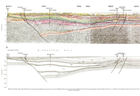
Fig. 12. Composite north–south 2D seismic line and interpreted geological cross section across the East Midlands hydrocarbon province from the Widmerpool Gulf to the Gainsborough Trough (modified after Fraser et al. 1990; Fraser & Gawthorpe 1990; see Figs 10 and 11 for
                                                                                                                  location of the seismic)