
Page 46 - An Atlas of Carboniferous Basin Evolution in Northern England
P. 46
Carboniferous basin development 25
except for fades changes associated with better developed marine conditions Permian in the Solway Basin. Central and southeastern parts of the basin are
towards the SW. Lack of exposure of the lower part of the Dinantian sequence characterized by open folds striking approximately north-south. Around the
in the centre of each basin previously prevented a full comparison of the northern and western margins asymmetric anticlines with steep west-facing
thickness of Dinantian strata. The regional seismic data confirm that both limbs are often reverse faulted, e.g. the Bewcastle anticline. Normal
basins underwent similar amounts of Dinantian extension with some 4-5 km of displacements of Permian strata on faults such as the Ninety Fathom reflect
early Carboniferous sediments deposited in the central parts of the basins (e.g. renewed extensional faulting in the Permo-Triassic.
Fig. 22).
Rift initiation occurred during the late Devonian Courceyan (EC1) with the
eruption of the alkaline basaltic Birrenswark/Kelso/Cockermouth lavas,
imaged as a series of high-amplitude reflectors on the regional seismic profile Tectono-sedimentary synthesis
(Fig. 22). Early syn-rift sedimentation was dominated by influxes of mature
fluvial siliciclastic detritus from the Southern Uplands, interbedded with the The Variscan plate cycle can be divided into syn-rift, post-rift and inversion
widespread Cementstone facies of fluvio-lacustrine origin (Leeder 1974) megasequences (Fig. 8). These describe a late Devonian-Dinantian rift-
forming the Lower Border Group and its correlatives. Regional seismic controlled subsidence, a Namurian-Westphalian thermally driven subsidence,
reflection data across the Northumberland Trough indicate an extremely thick and a late Westphalian to early Permian inversion or foreland basin phase.
Lower Border Group (EC1 sequence) in the hanging-wall of the Stublick- These in turn can be broken down into a series of depositional cycles or
Ninety Fathom fault system (Fig. 22). tectono-stratigraphic sequences which describe the late Devonian-Carbonifer-
The Courceyan-Chadian (EC1/EC2) Lower Border Group of Bewcastle and ous fill of the northern England basin.
Liddesdale comprises numerous peritidal carbonate and clastic deltaic cycles The syn-rift megasequence exhibits a characteristic wedge-shaped geometry
formed by the periodic advance of lobate deltas from the NE (Leeder 1974, that is exemplified by a four-fold increase in sediment thickness across the
Leeder et al 1989). On regional seismic data these facies are represented by a major basin-bounding fault of half graben such as the Gainsborough Trough,
series of stacked, laterally continuous, high-amplitude events, thought to reflect Bowland Basin and Stainmore Trough (Figs 12, 18 and 21). Isopachs for the
the interbedded nature of the interval (Fig. 22). upper part of this interval show the thickest sections to be confined to the
The diachronous advance of a major axial braided fluvial system, also from individual fault-bounded half graben (Fig. 2S). The border fault zones
the NE, is recorded in the Arundian to Holkerian Middle Border Group (EC3). bounding these are segmented, forming en echelon arrays, but the sparse 2D
On seismic data the sequence thickens to the north in the Northumberland seismic coverage and poor imaging of the earliest syn-rift inhibits detailed
Trough, suggesting that basin polarity switched between EC1 and EC3 rifting analysis of their growth and linkage history during rifting. However, by earliest
(Fig. 22). Conversely the EC3 sequence appears to thicken into the southern Dinantian times the basins had become well defined, suggesting that the faults
bounding fault of the Solway Basin. Outcrop studies indicate the presence of had essentially propagated laterally and linked to form their final lengths and,
multistorey fluvial channel belts within intra-basin lows defined by the thereafter, largely grew by increasing their displacement. The relatively fixed
Antonstown and Beckhead/Binky Linns Faults, suggesting syn-depositional fault lengths throughout the syn-rift megasequence and rapid localization of
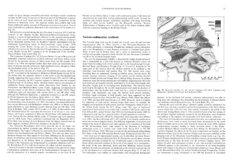
tectonic control on the alluvial architecture (Day 1970, Leeder 1987b). These displacement onto the border fault zones may be a result of reactivation of Fig. 23. Restored isopachs for the syn-rift sequences EC2-EC6 (Chadian-early
sandbodies split and intercalate with marine facies to the SW (Day 1970), basement fault lineaments (see page 10). Similar fault growth histories, Brigantian). Modified from Fraser & Gawthorpe (1990).
although the Thirlstane Sandstone, a suspected correlative to the SW, retains involving rapid attainment of fault lengths, have been suggested for fault
its fluvial signature into the Solway Basin (Ord et al 1988). populations from the East African Rift (e.g. Morely 1999), Timor Sea (Meyer deposits. In the shallower half graben, carbonate sedimentation was able to
The Asbian Upper Border Group (EC4) is composed of Yoredale-type cycles et al. 2002) and Suez Rift (Gawthorpe et al. 2002). However, there is evidence keep pace with subsidence thus precluding the development of rimmed shelves
in southwestern areas (Lumsden et al. 1967). In contrast, the central intra-basin for migration of fault activity between major fault zones, for example the and sediment-starved depocentres (e.g. the Leeds Basin, Fig. 19).
lows around Bewcastle and Bellingham contain over 2000 m of deltaic facies, hanging-wall migration of fault activity from the Thringstone-Sileby Faults to During the early post-rift phase, sediment supply overtook subsidence for
again deposited as axial drainage systems derived from the NE (Day 1970; the Hoton Fault during the ECS rifting event. This type of basinward the first time, allowing a marked southwards progradation of the fluvio-deltaic
Frost & Holliday 1980; Leeder 1987b; Leeder et al. 1989). In Berwickshire and migration of fault activity is recorded from a number of rift basins, such as the system which had, until this time, been mainly restricted to the north of the
NE Northumberland the equivalent Scremerston Coal Group is very much East African Rift, central Greece, Suez Rift (see Gawthorpe & Leeder 2000 for Alston and Askrigg Blocks (Fig. 9). This resulted in burial of the last vestiges of
thinner and largely composed of delta-top fluvial facies with numerous thick a discussion) and may be a general feature of fault population evolution. the northern England carbonate system in the late Brigantian-early Pendleian
coals. During the late Asbian, deltaic cycles of Yoredale type were deposited Within the constraints offered by independent biostratigraphic data (Ebdon and infilling of the remnant rift topography with fluvio-deltaic sediments.
over the whole basin. These conditions continued into the Brigantian (EC5- et al. 1990), the three rift pulses (EC1, ECS and EC5) are broadly synchronous The onset of Carboniferous compressional tectonics, on a regional scale, was
EC6) when some increase of cycle thickness from the Alston footwall into the across the northern England basins. The differing magnitudes of extension and diachronous from south to north. Foreland basin development in the south
basin suggests continued differential subsidence during EC5 times. timing of the main rift phase in each basin appears to be a function of the trend Wales Coalfield started in the early Namurian (Gayer & Jones 1989), whereas
The Namurian-Westphalian (LC1-LC2) post-rift fill of the basin was of the rift-bounding faults with respect to the direction of maximum compressional tectonics leading to basin inversion north of the Wales-
characterized by further Yoredale type, Millstone Grit and Coal Measures extensional stress as it rotated from north-south during EC1 to NE-SW London-Brabant Massif occurred much later during the Westphalian C. In
sedimentation. The Upper Carboniferous succession shows marked differences during EC5 (Fraser 1995). This may account for the pronounced rifting during northern England, the effects of the Variscan compression are marked on the
between the Northumberland and Solway Basins. Not only are there major EC5 times on the NE-SW-trending Hoton Fault, Widmerpool Gulf (Fig. 12). reflection seismic data by the presence of large-scale inversion anticlines in the
thickness changes but there appear to have been differences in the duration of Two main syn-rift depositional systems can be identified: (i) clastic fluvial- hanging-walls of the Dinantian basin-bounding normal faults (e.g. Fig. 18).
phases of subsidence and inversion/erosion (Johnson 1984). Slower subsidence deltaic and (ii) carbonate platforms (Fig. 9). During the syn-rift phase, tectonic Early Permian peneplaination of these anticlines created a pronounced angular
and deposition in the Solway Basin as compared to the Northumberland subsidence generally exceeded the rate of sediment supply to the basin and the unconformity at the base Permian over all northern England basins. The
Trough in the Namurian was compensated by continued subsidence well into clastic deltas remained confined to the north of the region. As a consequence, degree of uplift and subsequent erosion of syn- and post-rift Carboniferous
the Westphalian D (V1) with the formation of a thick red-bed succession. the south of the area (Bowland, Edale and East Midlands basins) became sediments appears to be controlled by the orientation of the basin-bounding
Intense inversion in the late Carboniferous resulted in the removal of Upper sediment starved and carbonates accumulated on the footwall crests giving rise faults with respect to the direction of maximum compressive stress. Basins such
Carboniferous sediments from most of the Northumberland Trough (Fig. 22) to the development of carbonate rimmed shelf margins (Figs 12, 17 and 18). as the Bowland Basin (Fig. 18) and the Northumberland Trough (Fig. 22) that
and the generation of a marked angular unconformity at the base of the The half-graben were infilled by calciturbidite and fine-grained hemipelagic are interpreted as lying orthogonal to the NW-SE direction of maximum