
Page 19 - Enhancing CAD Drawings with Photoshop
P. 19
4386.book Page 2 Monday, November 15, 2004 3:27 PM
2 CHAPTER 1 THE BASICS
geometry/Cartesian coordinate type of linear mathematical system. Let’s take a quick look at how
this works in AutoCAD.
1. Launch your CAD program. This book will use AutoCAD 2005, but many of the concepts are
similar in other CAD programs.
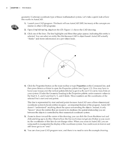
2. Open SimpleDrawing.dwg from the CD. Figure 1.1 shows the CAD drawing.
3. Click one of the lines. The line highlights and three blue grips appear, indicating this entity is
selected. You can select an entity like this because CAD is object based: AutoCAD actually
“thinks” and stores information on a per–object basis.
4. Click the Properties button on the main toolbar or type Properties on the Command line, and
then press Return or Enter to open the Properties palette (see Figure 1.2). (You may have to
hover your mouse over the vertical palette title bar to get it to fly out if it is set to Auto-hide on
your system.) Under the Geometry heading in the Properties palette, notice numeric values in
the Start X, Y, and Z and End X, Y, and Z fields. These numbers are the coordinates of the
selected line’s start and end points.
This line is represented by start and end points because AutoCAD uses a three-dimensional
coordinate system to locate entities in space—an important feature of the program. AutoCAD
doesn’t “understand” anything about the space surrounding the objects. Instead, it only
“knows” about the entities that are stored in its database; the spatial relationship you see
between the objects is controlled by their numerical coordinate system.
5. Zoom in closer toward the center of the drawing; you can click the Zoom Realtime tool and
click and drag up to do this. Observe how the line work does not get any thicker as you zoom
in; the coordinates of this line do not change either. When you zoom in AutoCAD, you are
using math to manipulate the display of the coordinate system. You could zoom in forever and
still never get to an “end.”
6. You can close your CAD program now, and there is no need to save the example drawing.