
Page 48 - Highway Engineering Handbook Building and Rehabilitating the Infrastructure
P. 48
ENVIRONMENTAL ISSUES 31
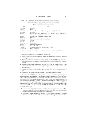
TABLE 1.10 Population Areas That Require Storm Water Permits (Continued)
D. Counties with unincorporated urbanized areas with population
greater than 100,000 and less than 250,000
State County
Alabama Jefferson
Arizona Pima
California Alameda, Contra Costa, Kern, Orange, Riverside, San Bernardino
Colorado Arapahoe
Florida Broward, Escambia, Hillsborough, Lee, Manatee, Orange, Palm Beach,
Pasco, Pinellas, Polk, Sarasota, Seminole
Georgia Clayton, Cobb, Fulton, Gwinnett, Richmond
Kentucky Jefferson
Louisiana East Baton Rouge Parish, Jefferson Parish
Maryland Howard
Nevada Clark
North Carolina Cumberland
Oregon Multnomah, Washington
South Carolina Greenville, Richland
Virginia Arlington, Chesterfield, Henrico, Prince William
Washington Pierce, Snohomish
Source: Adapted from Federal Register, vol. 55, no. 222, November 16, 1990, pp. 48073, 48074.
3. Scheduled beginning and ending dates of construction.
4. Identification of the receiving body of water, and storm water drainage information
including a site map.
5. Type of construction activity: transportation should be indicated if the project is a road-
way; utilities should be indicated for the installations of sewer, electric, and telephone
systems.
6. Material handling and management practices indicating the type of material to be
stored and handled on site and the management practices to be used to control storm
water pollution.
7. Regulatory status of the site, including approval status of the erosion or sediment control
plan.
8. Signature of the owner of the site certifying that the information is accurate.
Most statewide NPDES permits for general construction activities require the permit
holder to develop and implement a storm water pollution prevention plan (SWPPP) using
either best available technology economically achievable (BAT), best conventional tech-
nology (BCT), or best management practices (BMPs) to control pollutant discharge both
during and after construction activities. Once prepared, the SWPPP will be maintained at
the construction site by the highway department representative and made available on
request by the local enforcement agency. All contractors and subcontractors working at the
site are responsible for implementing the SWPPP. The SWPPP will generally include the
following components:
1. Location, including a 1/4-mi vicinity map that shows nearby surface water bodies,
drainage systems, wells, general topography, and location where storm water from the
construction activities will be discharged, including MS4s.
2. A site map that indicates the total site area and total area to be disturbed. This map
should indicate the location of the control practices to be implemented, areas where