
Page 375 - Laboratory Manual in Physical Geology
P. 375
49°
00’
54 30 000m. N.
54 20 000m. N.
(Courtesy of U.S. Geological Survey)
54 10 000m. N.
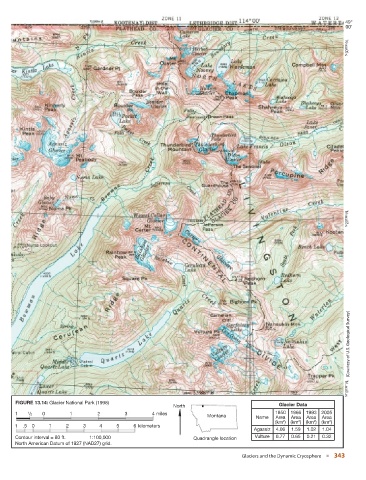
FIGURE 13.14: Glacier National Park (1998)
North Glacier Data
1 1 2 / 0 1 2 3 4 miles 1850 1966 1993 2005
Montana Name Area Area Area Area
2
2
(km ) (km ) (km ) (km ) 2
2
1 .5 0 1 2 3 4 5 6 kilometers
Agassiz 4.06 1.59 1.02 1.04
Contour interval = 80 ft. 1:100,000 Quadrangle location Vulture 0.77 0.65 0.21 0.32
North American Datum of 1927 (NAD27) grid.
Glaciers and the Dynamic Cryosphere ■ 343