
Page 376 - Laboratory Manual in Physical Geology
P. 376
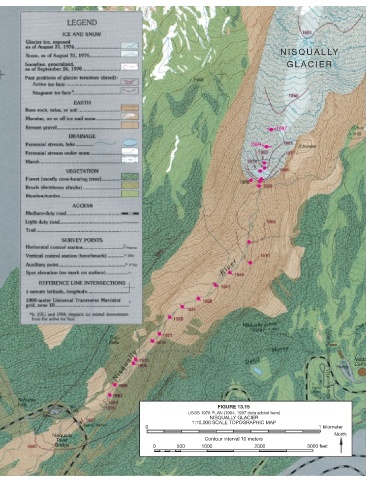
NISQUALLY

                                                                                                 GLACIER


                                                                                             1997


                                                                                     1994


                                                                                                               (Courtesy of U.S. Geological Survey)  Cente


                                                                                                                        Visito


                                                                          FIGURE 13.15
                                                                USGS 1976 PLAN (1994, 1997 data added here)
                                                                       NISQUALLY GLACIER
                                                                 1:10,000 SCALE TOPOGRAPHIC MAP
                                                  0                                                        1 kilometer
                  Nisqually                                                                                      North
                    River                                            Contour interval 10 meters
                   Bridge                           0       500     1000              2000              3000 feet

        344  ■  L ABOR ATORY  13