
Page 42 - Modern Spatiotemporal Geostatistics
P. 42
Spatiotemporal Mapping in Natural Sciences 23
mapping seeks a meaningful pattern that will make sense out of shapeless
heaps of data. The best way to deal with the situation is to develop a deeper
theoretical understanding and adapt the data-processing techniques to the new
theories.
In both cases considered above, the theory aims at deriving operational
concepts, i.e., concepts that concern potentially observable quantities and pro-
cesses which can be expressed in terms of efficient computer algorithms.
A geostatistician's first duty is to be creative. The second duty is to be
skeptical. The traits of creativity and skepticism are necessary complements
in science. In principle, the limits of BME analysis and mapping are of an
epistemic as well as an ontological nature. This is, of course, the case of
all predictive theories where epistemic limits are associated with our inability
to collect enough data, with poor understanding of the underlying physical
mechanisms, or with limited computational capabilities. Ontological limits, on
the other hand, could be due to the inherent complexity of the phenomenon
being mapped, the lack of causal relations and well-defined patterns, etc. While
modern geostatisticians should take conventional criticisms into consideration,
they should not be constrained unnecessarily by them.
The Integration Capability of Modern
Spatiotemporal Geostatistics
The practice of geostatistics is changing nowadays. Changes result from rapid
technological developments and globalization, as well as from the fact that
'science is becoming more interdisciplinary. Horizontal integration represents a
striking phenomenon of convergence in science which leads to new, highly in-
terdisciplinary fields, many of which lie at the frontier of current research. This
compels researchers and practitioners alike to be aware of developments and
challenges in fields other than their own. The methods of modern Spatiotem-
poral geostatistics can play a vital role in the horizontal integration among
disparate scientific disciplines. By integrating a variety of knowledge bases and
case-specific goals and objectives, the BME model of modern geostatistics can
generate highly informative Spatiotemporal maps that improve our understand-
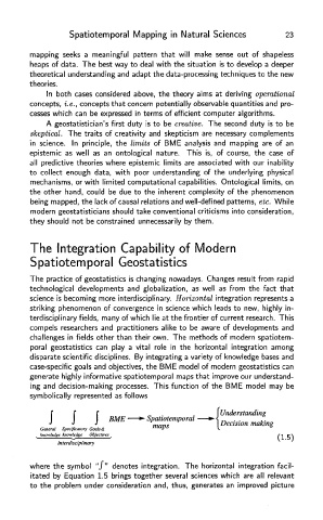
ing and decision-making processes. This function of the BME model may be
symbolically represented as follows
where the symbol "/" denotes integration. The horizontal integration facil-
itated by Equation 1.5 brings together several sciences which are all relevant
to the problem under consideration and, thus, generates an improved picture