
Page 61 - Sumatra Geology, Resources and Tectonic Evolution
P. 61
48 CHAPTER 4
~.i .~q~-~ 100~ ~ ~ . ~ ~ f ~ ~ 0 0 ~ 9 ~ .
J
::::::::::::::::::::::::
PADANG
TALANG
~A, 2579~
0
l~ Dibawah
C? ::::::::::::::::::::: ~ Volcano
:
:
...........:: :.:: Te rtia r~ i~st~ cs
4 ~l _((" ! iF 1 U"~ .~. "~ ~ ~. ~ " " " ~" Indarung Formation
/
~
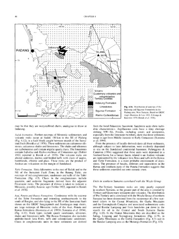
Fig. 4.16. Distribution of outcrops of the
--lO15 ' ~~nn/~'/~/'-'~'~.,~,~ ~ ~ SigunturFormation - Indarung and Siguntur Formations in the
Padang area, West Sumatra. Based on GRDC
o 5 ~ ~ / D '~ 1'oJ3o' 0~,,,-,. ~ ~ ~ ~ Permo-Carboniferous maps (Kastowo & Leo 1973; Silitonga &
Kastowo 1975; Rosidi et al. 1976).
may be that they are recrystallized cherts, analogous to those at from the local Palaeozoic basement. Sandstone units show turbi-
Indarung. ditic characteristics. Argillaceous units have a slaty cleavage
striking NW-SE. Fossils, including corals and ammonites,
Siulak Formation. Further outcrops of Mesozoic sedimentary and especially from the limestone members, show that these sediments
volcanic rocks occur at Siulak 150 km to the SE of Padang range in age from Middle Jurassic to Early Cretaceous (Suwarna
(Fig. 4.12), in a fault block caught between strands of the Suma- et al. 1994).
tran Fault (Rosidi et al. 1976). These sediments are calcareous silt- From the presence of locally-derived clasts all these sediments,
stones, calcareous shales and limestones. The shales and siltstones although subject to later deformation, were evidently deposited
are carbonaceous and contain angular quartz clasts. The limestones in situ on the Sundaland continental basement. Pulunggono &
contain Loftulisa and Hydrocorallinae of Cretaceous age (Tobler Cameron (1984) suggested that these units were deposited in a
1922, reported in Rosidi et al. 1976). The volcanic rocks are foreland basin, but a forearc basin, related to an Andean volcanic
altered andesites, dacites and bedded tufts with clasts of augite, arc represented by the volcanics lava flows and tufts in the Rawas
hornblende, chlorite and glass. These rocks are the product of and Tabir Formation, is a more probable environment of depo-
Andean arc volcanism on the margin of Sundaland. sition. The presence of basaits, dolerites and sepentinites in the
Rawas and southern parts of the Peneta Formation suggests that
Tabir Formation. Sixty kilometres to the east of Siulak and to the these sediments extended out onto oceanic crust.
NE of the Sumatran Fault Zone, in the Batang Tabir, are
outcrops of red conglomerates, sandstones and tufts of the Tabir
Formation (Fig. 4.5). Clasts in the conglomerates include
quartzite, and andesitic fragments derived from the adjacent Units in southern Sumatra correlated with the Woyla Group
Palaeozoic rocks. The presence of Ostrea is taken to indicate a
Mesozoic, possibly Jurassic age (Tobler 1922, reported in Rosidi The Pre-Tertiary basement rocks are very poorly exposed
et al. 1976). in southern Sumatra, as the greater part of the area is covered by
Tertiary and Quaternary sediments and volcanics. The distribution
Asai, Peneta and Rawas Formations. Continuous with the outcrop of Pre-Tertiary units correlated with the Woyla Group of northern
of the Tabir Formation and extending southeastwards to the Sumatra has been determined from the occurrence of a few scat-
south of Bangko, and also lying to the NE of the Sumatran Fault tered inliers in the Gumai Mountains, the Garba Mountains
shown on the GRDC Sungaipenuh and Sarolangan map sheets, and the Gunungkasih Complex and associated sedimentary units
are large outcrops of Mesozoic rocks of the Asai, Peneta and around Bandar Lampung and from boreholes put down in the
Rawas formations (Kusnama et al. 1993b; Suwarna et al. 1994), search for oil in the Central and South Sumatra Basins
(Fig. 4.12). Rock types include quartz sandstones, siltstones, (Fig. 4.18). In the Gumai Mountains they are described as the
shales and limestones tufts. The Rawas Formation also includes Saling, Lingsing and Sepingtiang formations (Fig. 4.19), in
andesite-basalt lava flows, tufts and volcaniclastic sandstones. the Garba Mountains as the Garba Formation (Fig. 4.7) and in
Clasts in conglomeratic units in these sediments are derived the Bandar Lampung area as the Menanga Formation (Fig. 4.8).