
Page 125 - Volcano and Geothermal Tourism
P. 125
102 The Americas
marked by a narrow depression between the de Tucle–Loma Lucero horst and on the west by
mountains and the sea. To the north the land rises El Tatio volcanics (Lahsen and Trujillo, 1976; de
and becomes more arid, until one reaches the Silva and Francis, 1991). The geothermal field at
forbidding Atacama Desert, one of the most elevations from 4200 to 4600m covers
2
inhospitable regions on Earth. To the south just approximately 30km , but the majority of the
2
the opposite transformation takes place: the land thermal features are found within 10km , in three
falls away, and the region between mountains and distinct basins (upper, middle and lower basin).
ocean fades into the baffling archipelagic maze From here, several small colourful streams coalesce
that terminates in Chilean Patagonia. As with to form the Rio Salado which drains westward
many other countries on the Pacific Ocean through a narrow valley in the horst block
coastline Chile has large geographical faults and a forming the margin of the graben. Most of the
high geothermal activity, which explains the springs are near boiling (86°C) at a neutral pH.
existence of numerous sources of thermal waters. Siliceous sinter deposits are found throughout the
One of the most famous geothermal fields in field, sometimes as large cones at geyser vents or
Chile is El Tatio. as terraces at springs. Runoff from El Tatio forms
the headwaters of the Calama Basin, where
El Tatio geology recharge is dominantly from mountain snowmelt.
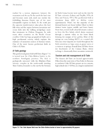
The geothermal geyser field at El Tatio (Figure 7.4)
is located near the Chile–Bolivia border in the Tourism and risk management at El Tatio
northern Antofagasta province. The field is The Geysers del Tatio are located approximately
geologically associated with the Altiplano–Puna 80km from the oasis town of San Pedro de Atacama
volcanic complex in the north–south trending in northern Chile. El Tatio geysers are in a remote,
Tatio Graben, bounded on the east by the Serrania high altitude site (>4300m), in a largely uninhabited
Figure 7.4 The Tatio Geyser field near the Chile–Bolivia border is home to approximately 80 geysers
Ch07.indd 102 3/28/2010 1:27:58 PM