
Page 214 - Volcano and Geothermal Tourism
P. 214
Volcano Tourism in the Philippines 191
worthy of close study to prevent future natural within the past millennium, and the site of an
disasters (Hargrove, 1991). aborted geothermal development. Geologically
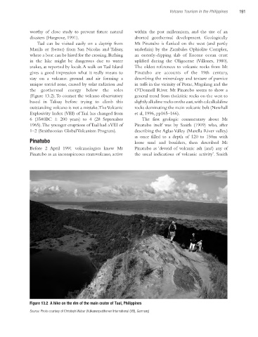
Taal can be visited easily on a daytrip from Mt Pinatubo is flanked on the west (and partly
Manila or (better) from San Nicolas and Talisay, underlain) by the Zambales Ophiolite Complex,
where a boat can be hired for the crossing. Bathing an easterly-dipping slab of Eocene ocean crust
in the lake might be dangerous due to water uplifted during the Oligocene (Villones, 1980).
snakes, as reported by locals. A walk on Taal Island The oldest references to volcanic rocks from Mt
gives a good impression what it really means to Pinatubo are accounts of the 19th century,
stay on a volcano: ground and air forming a describing the mineralogy and texture of pumice
unique torrid zone, caused by solar radiation and in tuffs in the vicinity of Porac, Magalang and the
the geothermal energy below the soles O’Donnell River. Mt Pinatubo seems to show a
(Figure 13.2). To contact the volcano observatory general trend from tholeiitic rocks on the west to
based in Talisay before trying to climb this slightly alkaline rocks on the east, with calcalkalaline
outstanding volcano is not a mistake. The Volcanic rocks dominating the main volcanic belt (Newhall
Explosivity Index (VEI) of Taal has changed from et al, 1996, pp165–166).
6 (3580BC ± 200 years) to 4 (28 September The first geologic commentary about Mt
1965). The younger eruptions of Taal had a VEI of Pinatubo itself was by Smith (1909) who, after
1–2 (Smithsonian Global Volcanism Program). describing the Aglao Valley (Marella River valley)
as once filled to a depth of 120 to 150m with
Pinatubo loose sand and boulders, then described Mt
Before 2 April 1991 volcanologists knew Mt Pinatubo as ‘devoid of volcanic ash (and) any of
Pinatubo as an inconspicuous stratovolcano, active the usual indications of volcanic activity’. Smith
Figure 13.2 A hike on the rim of the main crater of Taal, Philippines
Source: Photo courtesy of Christoph Weber (Vulkanexpeditionen International (VEI), Germany)
Ch13.indd 191 4/7/2010 12:03:41 PM