
Page 85 - Moving the Earth_ The Workbook of Excavation
P. 85
SURVEYS AND MEASUREMENTS
SURVEYS AND MEASUREMENTS 2.35
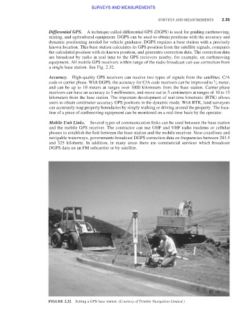
Differential GPS. A technique called differential GPS (DGPS) is used for guiding earthmoving,
mining, and agricultural equipment. DGPS can be used to obtain positions with the accuracy and
dynamic positioning needed for vehicle guidance. DGPS requires a base station with a precisely
known location. This base station calculates its GPS position from the satellite signals, compares
the calculated position with its known position, and generates correction data. The correction data
are broadcast by radio in real time to the GPS receivers nearby, for example, on earthmoving
equipment. All mobile GPS receivers within range of the radio broadcast can use correction from
a single base station. See Fig. 2.32.
Accuracy. High-quality GPS receivers can receive two types of signals from the satellites: C/A
1
code or carrier phase. With DGPS, the accuracy for C/A code receivers can be improved to ⁄ 2 meter,
and can be up to 10 meters at ranges over 1000 kilometers from the base station. Carrier-phase
receivers can have an accuracy to 5 millimeters, and move out to 5 centimeters at ranges of 10 to 15
kilometers from the base station. The important development of real-time kinematic (RTK) allows
users to obtain centimeter-accuracy GPS positions in the dynamic mode. With RTK, land surveyors
can accurately map property boundaries by simply walking or driving around the property. The loca-
tion of a piece of earthmoving equipment can be monitored on a real-time basis by the operator.
Mobile Unit Links. Several types of communication links can be used between the base station
and the mobile GPS receiver. The contractor can use UHF and VHF radio modems or cellular
phones to establish the link between the base station and the mobile receiver. Near coastlines and
navigable waterways, governments broadcast DGPS correction data on frequencies between 283.5
and 325 kilohertz. In addition, in many areas there are commercial services which broadcast
DGPS data on an FM subcarrier or by satellite.
FIGURE 2.32 Setting a GPS base station. (Courtesy of Trimble Navigation Limited.)