
Page 142 - Basic Well Log Analysis for Geologist
P. 142
LITHOLOGY LOGGING AND MAPPING TECHNIQUES
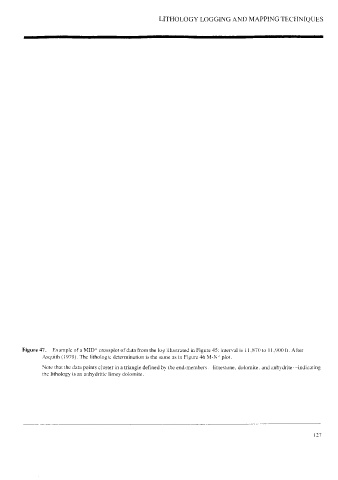
Figure 47. Example of a MID* crossplot of data from the log illustrated in Figure 45; interval is [1,870 to 11,900 ft. After
Asquith (1979). The lithologic determination is the same as in Figure 46 M-N* plot.
Note that the data points cluster in a triangle defined by the end-members—limestone, dolomite. and anhydrite~indicating
the lithology is an anhydritic limey dolomite.
127