
Page 163 - Encyclopedia Of World History Vol V
P. 163
1940 berkshire encyclopedia of world history
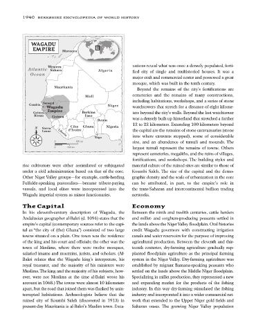
WAGADU
EMPIRE Morocco
Western vations reveal what was once a densely populated, forti-
Atlantic Sahara Algeria fied city of single and multistoried houses. It was a
Ocean
major craft and commercial center and possessed a great
mosque, which was built in the tenth century.
Mauritania
Beyond the remains of the city’s fortifications are
Mali cemeteries and the remains of many constructions,
including habitations, workshops, and a series of stone
Senegal
Gambia Niger
Wagadu watchtowers that stretch for a distance of eight kilome-
Empire
Guinea- Burkina ters beyond the city’s walls. Beyond the last watchtower
Bissau Guinea Faso
Benin was a densely built up hinterland that stretched a further
12 to 22 kilometers. Extending 100 kilometers beyond
N Sierra Côte Ghana Nigeria
Leone Liberia d’Ivoire the capital are the remains of stone caravansaries (stone
inns where caravans stopped), some of considerable
Togo
0 500 mi size, and an abundance of tumuli and mounds. The
0 500 km largest tumuli represent the remains of towns. Others
represent cemeteries, megaliths, and the ruins of villages,
fortifications, and workshops. The building styles and
rice cultivators were either assimilated or subjugated material culture of the ruined sites are similar to those of
under a civil administration based on that of the core. Koumbi Saleh. The size of the capital and the demo-
Other Niger Valley groups—for example, cattle-herding graphic density and the scale of urbanization in the core
Fulfulde-speaking pastoralists—became tribute-paying can be attributed, in part, to the empire’s role in
vassals, and local elites were incorporated into the the trans-Saharan and intercontinental bullion trading
Wagadu imperial system as minor functionaries. networks.
The Capital Economy
In his eleventh-century description of Wagadu, the Between the ninth and twelfth centuries, cattle herders
Andalusian geographer al-Bakri (d. 1094) states that the and millet- and sorghum-producing peasants settled in
empire’s capital (contemporary sources refer to the capi- the lands above the Niger Valley floodplain. Oral histories
tal as “the city of (the) Ghana”) consisted of two large credit Wagadu governors with constructing irrigation
towns situated on a plain. One town was the residence canals and water reservoirs for the purpose of improving
of the king and his court and officials; the other was the agricultural production. Between the eleventh and thir-
town of Muslims, where there were twelve mosques, teenth centuries, dry-farming agriculture gradually sup-
salaried imams and muezzins, jurists, and scholars. (Al- planted floodplain agriculture as the principal farming
Bakri relates that the Wagadu king’s interpreters, his system in the Niger Valley. Dry-farming agriculture was
royal treasurer, and the majority of his ministers were established by migrant Bamana-speaking peasants who
Muslims.The king and the majority of his subjects, how- settled on the lands above the Middle Niger floodplain.
ever, were not Muslims at the time al-Bakri wrote his Specializing in millet production, they represented a new
account in 1068.) The towns were almost 10 kilometers and expanding market for the products of the fishing
apart, but the road that joined them was flanked by unin- industry. In this way dry-farming stimulated the fishing
terrupted habitations. Archaeologists believe that the industry and incorporated it into a wider commercial net-
ruined city of Koumbi Saleh (discovered in 1913) in work that extended to the Upper Niger gold fields and
present-day Mauritania is al-Bakri’s Muslim town. Exca- Saharan oases. The growing Niger Valley population