
Page 233 - Carbonate Facies in Geologic History
P. 233
tv tv o ;:p 3 o ~ ...., ~. </> '" n' to E. 0:: c "0 </> ~ ::l 0- r ~ rD >-I ...., ~. '" n' tTl (') o ~ n' :::<:I (1) (1) w
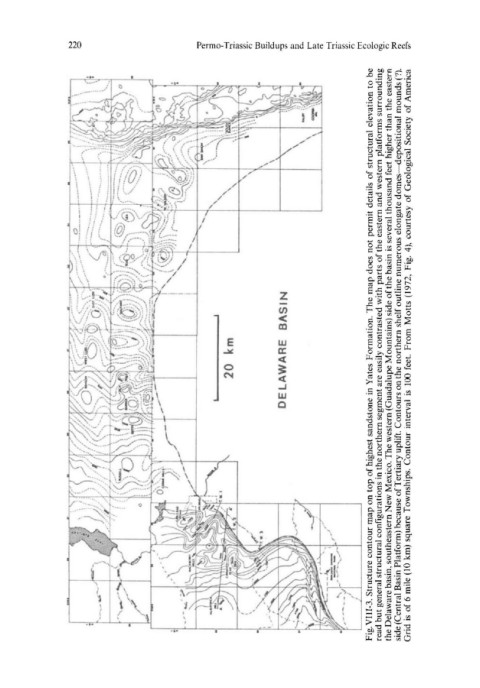
BASIN From Motts (1972, Fig. 4), courtesy of Geological Society of America
km Fig. VIII-3. Structure contour map on top of highest sandstone in Yates Formation. The map does not permit details of structural elevation to be read but general structural configurations in the northern segment are easily contrasted with parts of the eastern and western platforms surrounding the Delawa
20 DELAWARE 100 feet. is Grid is of 6 mile (10 km) square Townships. Contour interval