
Page 40 - Hydrocarbon
P. 40
Exploration 27
gravirty anomaly uncorrected (Bouguer anomaly)
corrected
gravity
gravity
distance along profile line
meter
salt
2.1 g/cm 3
clastics
2.4 g/cm 3
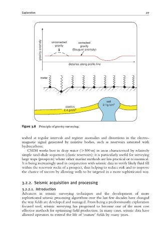
Figure 3.8 Principle of gravity surveying.
seabed at regular intervals and register anomalies and distortions in the electro-
magnetic signal generated by resistive bodies, such as reservoirs saturated with
hydrocarbons.
CSEM works best in deep water (W500 m) in areas characterised by relatively
simple sand-shale sequences (clastic reservoirs); it is particularly useful for surveying
large traps (prospects) where other marine methods are less practical or economical.
It is being increasingly used in conjunction with seismic data to verify likely fluid fill
within the reservoir rocks of a prospect, thus helping to reduce risk and to improve
the chance of success by allowing wells to be targeted in a more sophisticated way.
3.2.2. Seismic acquisition and processing
3.2.2.1. Introduction
Advances in seismic surveying techniques and the development of more
sophisticated seismic processing algorithms over the last few decades have changed
the way fields are developed and managed. From being a predominantly exploration
focused tool, seismic surveying has progressed to become one of the most cost
effective methods for optimising field production. In many cases, seismic data have
allowed operators to extend the life of ‘mature’ fields by many years.