
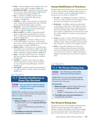
Page 413 - Laboratory Manual in Physical Geology
P. 413
■     Delta —a sediment deposit at the mouth of a river where         Human Modification of Shorelines
                   it enters an ocean or lake. (emergent,   FIGURE   15.2   ).

                    ■     Headland with cliffs —projection of land that  extends     Humans build several common types of coastal structures
                   into an ocean or lake and generally has cliffs along its   in order to protect harbors, build up sandy beaches, or

                   water boundary (submergent,   FIGURE   15.3   ).      extend the shoreline. Study the following four kinds of
                    ■     Spit —a sand bar extending from the end of   structures and their effects in   FIGURE   15.6   .
                   a beach into the mouth of an adjacent bay         ■  Sea wall—an embankment of boulders, reinforced
                    (emergent,   FIGURE  15.2   ).                      concrete, or other material constructed against a shore-

                    ■     Tidal flat —muddy or sandy area that is covered with   line to prevent erosion by waves and currents.
                   water at high tide and exposed at low tide. Tidal flats
                   are best developed along emergent  coastlines.     ■  Breakwater—an offshore wall constructed parallel
                    ■     Saltmarsh —a marsh that is flooded by ocean water   to a shoreline to break waves. The longshore current
                   at high tide. Saltmarshes are best developed along   is halted behind such walls, so the sand accumulates
                   emergent coastlines (  FIGURE  15.2   ).             there and the beach widens. Where the breakwater is

                    ■     Wave-cut cliff  (or  sea cliff )—a seaward-facing cliff   used to protect a harbor from currents and waves, sand
                   along a steep shoreline, produced by wave erosion.   often collects behind the breakwater and may have to
                   Wave-cut cliffs are best developed along submergent   be dredged.
                   coastlines ( FIGURE   15.3   ).                   ■  Groin (or groyne)—a short wall constructed perpen-
                    ■     Wave-cut platform —a bench or shelf at sea level   dicular to shoreline in order to trap sand and make or
                   (or lake level) along a steep shore, and formed by   build up a beach. Sand accumulates on the up-current
                   wave erosion. Wave-cut platforms are best developed   side of the groin in relation to the longshore current.
                   along emergent coastlines (  FIGURE  15.2   ).

                    ■     Marine terrace —an elevated wave-cut platform that   ■  Jetties—long walls extending from shore at the
                   is bounded on its seaward side by a cliff or steep slope   mouths of harbors and used to protect the harbor
                   (and formed when a wave-cut platform is elevated by   entrance from filling with sand or being eroded by
                   uplift or regression; emergent coastline,   FIGURE  15.2   ).    waves and currents. Jetties are usually constructed of

                    ■     Stack —an isolated rocky island near a headland   boulders and in pairs (one on each side of a harbor or
                   cliff, best developed along submergent coastlines    inlet).
                   (  FIGURE  15.3   ).

                    ■     Tombolo —a sand bar that connects an island
                   with the mainland or another island. Tombolos
                   are best  developed along submergent coastlines   ACTIVITY
                   (  FIGURE   15.3   ).
                    ■     Tied island —an island connected to the mainland       15.4  The Threat of Rising Seas
                   or another island by a tombolo (usually submergent,
                     FIGURE  15.3   ).

                                                                             THINK  How will rising sea levels affect
                ACTIVITY                                             About It   | communities along shorelines?


                     15.3  Shoreline Modification at                    OBJECTIVE   Describe the probability of global
                         Ocean City, Maryland                        sea-level rise and analyze the coastal hazards and
                                                                     increased risks it may cause.
                       THINK |  How successful are efforts to protect     PROCEDURES
                 About It  shorelines from erosion by building            1.     Before you begin , read The Threat of Rising Seas
                           artificial structures?                        below. Also, this is  what you will need :
                                                                            ___ calculator

                    OBJECTIVE   Identify the common types of artifi cial     ___  Activity 15.4 Worksheet (p.  390  ) and pencil
                 structures used to modify shorelines and explain their

                 effects on coastal environments.                        2.     Then follow your instructor’s directions  for
                                                                         completing the worksheets.
                   PROCEDURES
                      1.     Before you begin , read Human Modifi cation of
                    Shorelines below. Also, this is  what you will need :          The Threat of Rising Seas
                       ___ ruler, calculator                          The National Oceanic and Atmospheric Administration
                      ___  Activity 15.3 Worksheets (pp.  388–389 ) and   (NOAA), using measurements from satellite radar
                        pencil                                      altimeters, estimates that global sea level has been rising
                     2.     Then follow your instructor’s directions  for   at a rate of 2.9 mm/yr since 1992. Meanwhile, a 2013
                    completing the worksheets.                      report by Working Group 1 of the Intergovernmental

                                                                          Coastal Processes, Landforms, Hazards, and Risks   ■  381