Page 28 - Water Engineering Hydraulics, Distribution and Treatment
P. 28

6
                                                 Introduction to Water Systems
                                        Chapter 1
                                                                                       runoff rather than groundwater. Water seeps from the ground
                                                                                       when surface streams are low and to the ground when sur-
                                                                                       face streams are high. Release of water from ground storage
                                                                                       or from accumulations of snow in high mountains is a deter-
                                                                                       mining factor in the yield of some catchment areas. Although
                                                                                       surface waters are derived ultimately from precipitation, the
                                                                                       relations between precipitation, runoff, infiltration, evapora-
                                                                                       tion, and transpiration are so complex that engineers rightly
                                                                                       prefer to base calculations of yield on available stream gaug-
                                                                                       ings. For adequate information, gaugings must extend over a
                                                                                       considerable number of years.
                                                                                       1.6 GROUNDWATER
                                                                                       Smaller in daily delivery, but many times more numerous
                                                                                       than surface water supplies, are the municipal and private
                                                                                       groundwater supplies of North America. Groundwater is
                                                                                       drawn from many different geological formations: (a) from
                                                                                       the pores of alluvial (water-borne), glacial, or aeolian (wind-
                                                                                       blown) deposits of granular, unconsolidated materials such
                                                                                       as sand and gravel, and from consolidated materials such as
                                                                                       sandstone; (b) from the solution passages, caverns, and cleav-
                                                                                       age planes of sedimentary rocks such as limestone, slate, and
                                                                                       shale; (c) from the fractures and fissures of igneous rocks;
                                                                                       and (d) from combinations of these unconsolidated and con-
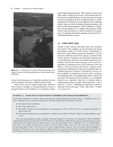
                                    Figure 1.2 A watershed lake in Western Missouri provides water
                                                                                       solidated geological formations. Groundwater sources, too,
                                    supply (Courtesy of the National Resources Conservation Service
                                                                                       have an intake or catchment area, but the catch, or recharge,
                                    and USDA).
                                                                                       is by infiltration into soil openings rather than by runoff over
                                                                                       its surface. The intake area may be nearby or a considerable
                                    erosion. Recreational uses of watersheds and reservoirs may  distance away, especially when flow is confined within a
                                    call for treatment of the flows withdrawn from storage.  water-bearing stratum or aquifer (from Latin aqua,“water,”
                                        Much of the water in streams, ponds, lakes, and reser-  and ferre, “to bear”) underlying an impervious stratum or
                                    voirs in times of drought, or when precipitation is frozen, is  aquiclude (from Latin aqua, “water,” and cludere, “to shut”
                                    seepage from the soil. Nevertheless, it is classified as surface  or “to close out”).
                                      EXAMPLE 1.2 ESTIMATES OF YIELDS FROM WATERSHEDS AND STORAGE REQUIREMENTS
                                      Certain rough estimates of the yield of surface watersheds and storage requirements are shown in Fig. 1.1. Rainfall is used as the
                                      point of departure, merely to identify the dimensions of possible rainfall–runoff relationships. Determine
                                          1. The yields from the watersheds,
                                          2. The storage requirements,
                                                                                                         2
                                                                                                  2
                                          3. The number of people who can be supported by a drainage area of 100 mi (259 km ) if there is adequate impoundage for
                                            water storage, and
                                                                                                         2
                                                                                                  2
                                          4. The number of people who can be supported by a drainage area of 100 mi (259 km ) if there is no impoundage for water
                                            storage.
                                                                                     2
                                                                                                        2
                                          The following assumptions are made: (a) rainfall = 20 in.∕km annually = 19.6cm∕km , (b) a stream flow of about 1 MGD/km 2
                                                                                              2
                                                                                2
                                                                           3
                                      (million gallons per day per square mile) or (1.547 ft /s)/km [or 1.46 MLD/km (million liters per day per square kilometer)] is a good
                                                                                                                2
                                                                                                                                   2
                                      average for the well-watered sections of North America, (c) for 75% development (0.75 × 1MGD∕km or 0.75 × 1.46 MLD∕km ),
                                      about half a year’s supply must generally be stored. In semiarid regions storage of three times the mean annual stream flow is
                                      not uncommon, that is, water is held over from wet years to supply demands during dry years, (d) average water consumption =
                                      150 gpcd = 567.8 Lpcd, (e) for water supply by continuous draft, low water flows rather than average annual yields govern. In
                                                                                                                                2
                                                                                     3
                                                                                                    2
                                      well-watered sections of North America, these approximate 0.1 ft /s or 64,600 gpd/km (or 28.32 L/s, or 0.094316 MLD/km ).
   23   24   25   26   27   28   29   30   31   32   33