
Page 30 - Water Engineering Hydraulics, Distribution and Treatment
P. 30
8
Chapter 1
Introduction to Water Systems
The maximum yield of groundwater is directly propor-
tional to the size of the intake area and to the difference
between precipitation and the sum of evapotranspiration and
storm runoff. Laterally, flow extends across the width of the
aquifer; vertically, it is as deep as the zone of open pores
and passages in Earth’s crust and as shallow as the ground-
water table. When the water surface rises and falls with
seasonal changes in recharge, flow is unconfined or free, and
the groundwater table slopes downward more or less parallel
to the ground surface. Flow then moves at right angles to
the water table contours. If a porous stratum dips beneath
an impervious layer, flow is confined as in a pipe dropping
below the hydraulic grade line. When this kind of aquifer is
tapped, artesian water rises from it under pressure, in some
geological situations, even in free-flowing fountains. In other
geological formations, water is perched on a lens of imper-
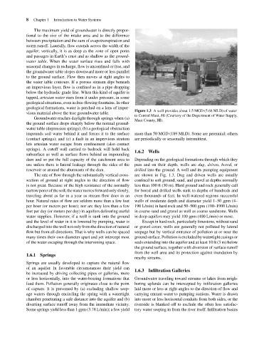
Figure 1.3 A well provides about 1.5 MGD (5.68 MLD) of water
vious material above the true groundwater table.
to Central Maui, HI (Courtesy of the Department of Water Supply,
Groundwater reaches daylight through springs when (a)
Maui County, HI).
the ground surface drops sharply below the normal ground-
water table (depression springs); (b) a geological obstruction
impounds soil water behind it and forces it to the surface more than 50 MGD (189 MLD). Some are perennial; others
(contact springs); and (c) a fault in an impervious stratum are periodically or seasonally intermittent.
lets artesian water escape from confinement (also contact
springs). A cutoff wall carried to bedrock will hold back
1.6.2 Wells
subsurface as well as surface flows behind an impounding
dam and so put the full capacity of the catchment area to Depending on the geological formations through which they
use unless there is lateral leakage through the sides of the pass and on their depth, wells are dug, driven, bored,or
reservoir or around the abutments of the dam. drilled into the ground. A well and its pumping equipment
The rate of flow through the substantially vertical cross- are shown in Fig. 1.3. Dug and driven wells are usually
section of ground at right angles to the direction of flow confined to soft ground, sand, and gravel at depths normally
is not great. Because of the high resistance of the normally less than 100 ft (30 m). Hard ground and rock generally call
narrowpores of thesoil, thewater moves forwardonlyslowly, for bored and drilled wells sunk to depths of hundreds and
traveling about as far in a year as stream flow does in an even thousands of feet. In well-watered regions successful
hour. Natural rates of flow are seldom more than a few feet wells of moderate depth and diameter yield 1–50 gpm (4–
per hour (or meters per hour); nor are they less than a few 190 L/min) in hard rock and 50–500 gpm (190–1900 L/min)
feet per day (or meters per day) in aquifers delivering useful in coarse sand and gravel as well as coarse sandstone. Wells
water supplies. However, if a well is sunk into the ground in deep aquifers may yield 100 gpm (400 L/min) or more.
and the level of water in it is lowered by pumping, water is Except in hard rock, particularly limestone, without sand
discharged into the well not only from the direction of natural or gravel cover, wells are generally not polluted by lateral
flow but from all directions. That is why wells can be spaced seepage but by vertical entrance of pollution at or near the
many times their own diameter apart and yet intercept most ground surface. Pollution is excluded by watertight casings or
of the water escaping through the intervening space. seals extending into the aquifer and at least 10 ft (3 m) below
the ground surface, together with diversion of surface runoff
from the well area and its protection against inundation by
1.6.1 Springs
nearby streams.
Springs are usually developed to capture the natural flow
of an aquifer. In favorable circumstances their yield can
1.6.3 Infiltration Galleries
be increased by driving collecting pipes or galleries, more
or less horizontally, into the water-bearing formations that Groundwater traveling toward streams or lakes from neigh-
feed them. Pollution generally originates close to the point boring uplands can be intercepted by infiltration galleries
of capture. It is prevented by (a) excluding shallow seep- laid more or less at right angles to the direction of flow and
age waters through encircling the spring with a watertight carrying entrant water to pumping stations. Water is drawn
chamber penetrating a safe distance into the aquifer and (b) into more or less horizontal conduits from both sides, or the
diverting surface runoff away from the immediate vicinity. riverside is blanked off to exclude the often less satisfac-
Some springs yield less than 1 gpm (3.78 L/min); a few yield tory water seeping in from the river itself. Infiltration basins