
Page 64 - Encyclopedia Of World History Vol IV
P. 64
n a viga tion 1365
navigation 1365
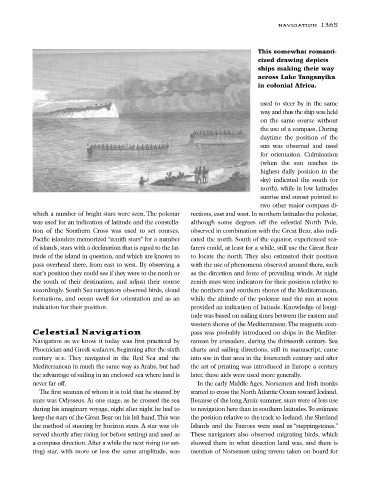
This somewhat romanti-
cized drawing depicts
ships making their way
across Lake Tanganyika
in colonial Africa.
used to steer by in the same
way and thus the ship was held
on the same course without
the use of a compass. During
daytime the position of the
sun was observed and used
for orientation. Culmination
(when the sun reaches its
highest daily position in the
sky) indicated the south (or
north), while in low latitudes
sunrise and sunset pointed to
two other major compass di-
which a number of bright stars were seen. The polestar rections, east and west. In northern latitudes the polestar,
was used for an indication of latitude and the constella- although some degrees off the celestial North Pole,
tion of the Southern Cross was used to set courses. observed in combination with the Great Bear, also indi-
Pacific islanders memorized “zenith stars” for a number cated the north. South of the equator, experienced sea-
of islands, stars with a declination that is equal to the lat- farers could, at least for a while, still use the Great Bear
itude of the island in question, and which are known to to locate the north. They also estimated their position
pass overhead there, from east to west. By observing a with the use of phenomena observed around them, such
star’s position they could see if they were to the north or as the direction and force of prevailing winds. At night
the south of their destination, and adjust their course zenith stars were indicators for their position relative to
accordingly. South Sea navigators observed birds, cloud the northern and southern shores of the Mediterranean,
formations, and ocean swell for orientation and as an while the altitude of the polestar and the sun at noon
indication for their position. provided an indication of latitude. Knowledge of longi-
tude was based on sailing times between the eastern and
western shores of the Mediterranean.The magnetic com-
Celestial Navigation pass was probably introduced on ships in the Mediter-
Navigation as we know it today was first practiced by ranean by crusaders, during the thirteenth century. Sea
Phoenician and Greek seafarers, beginning after the sixth charts and sailing directions, still in manuscript, came
century BCE. They navigated in the Red Sea and the into use in that area in the fourteenth century and after
Mediterranean in much the same way as Arabs, but had the art of printing was introduced in Europe a century
the advantage of sailing in an enclosed sea where land is later, these aids were used more generally.
never far off. In the early Middle Ages, Norsemen and Irish monks
The first seaman of whom it is told that he steered by started to cross the North Atlantic Ocean toward Iceland.
stars was Odysseus. At one stage, as he crossed the sea Because of the long Arctic summer, stars were of less use
during his imaginary voyage, night after night he had to to navigation here than in southern latitudes.To estimate
keep the stars of the Great Bear on his left hand.This was the position relative to the track to Iceland, the Shetland
the method of steering by horizon stars. A star was ob- Islands and the Faeroes were used as “steppingstones.”
served shortly after rising (or before setting) and used as These navigators also observed migrating birds, which
a compass direction. After a while the next rising (or set- showed them in what direction land was, and there is
ting) star, with more or less the same amplitude, was mention of Norsemen using ravens taken on board for