
Page 199 - Carbonate Facies in Geologic History
P. 199
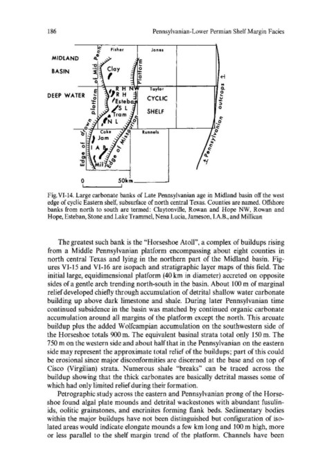
186                           Pennsylvanian-Lower Permian Shelf Margin Facies

                                 Fisher      Jones
                MIDLAND
                BASIN

                        ----~~-,~~~--~~--~--------~~
               DEEP  WATER  e                                    ~
                            ~                                   *
                           ~                                     0
                            Q.              SHELF
                          ~~
                      ~o~~'---~~~R~u-nn-e~ls--'-~------~


                         o         50km ___ ~
                         !  .... --------....j!
               Fig. VI-14. Large carbonate banks  of Late Pennsylvanian age in Midland basin off the west
               edge of cyclic Eastern shelf, subsurface of north central Texas. Counties are named. Offshore
               banks from  north to south are termed:  Claytonville, Rowan  and  Hope  NW,  Rowan  and
               Hope, Esteban, Stone and Lake Trammel, Nena Lucia, Jameson, I.A.B., and Millican


                  The greatest such bank is the "Horseshoe Atoll", a complex of buildups rising
               from  a  Middle  Pennsylvanian  platform  encompassing  about  eight  counties  in
               north central Texas  and lying in the northern part of the  Midland  basin.  Fig-
               ures VI-15 and VI-16  are isopach and stratigraphic layer maps of this field.  The
               initial large, equidimensional platform (40 km in diameter) accreted on opposite
               sides of a gentle arch trending north-south in the basin. About 100 m of marginal
               relief developed chiefly through accumulation of detrital shallow water carbonate
               building  up above dark limestone and  shale.  During later  Pennsylvanian  time
               continued subsidence in the basin was matched by continued organic carbonate
               accumulation around all margins of the platform except the north. This arcuate
               buildup plus the added Wolfcampian accumulation on the southwestern side  of
               the Horseshoe totals 900 m.  The equivalent basinal strata total only 150 m.  The
               750 m on the western side and about half that in the Pennsylvanian on the eastern
               side may represent the approximate total relief of the buildups; part of this could
               be erosional since major disconformities are discerned at the base and on top of
               Cisco  (Virgil ian)  strata.  Numerous  shale  "breaks"  can  be  traced  across  the
               buildup showing that the thick carbonates are basically detrital masses some of
               which had only limited relief during their formation.
                  Petrographic study across the eastern and Pennsylvanian prong of the Horse-
               shoe found algal plate mounds and detrital wackestones with abundant fusulin-
               ids,  oolitic grainstones, and encrinites  forming  flank  beds.  Sedimentary  bodies
               within the major buildups have not been distinguished but configuration of iso-
               lated areas would indicate elongate mounds a few km long and 100 m high, more
               or less  parallel  to the  shelf margin trend  of the  platform.  Channels  have  been