
Page 233 - Digital Analysis of Remotely Sensed Imagery
P. 233
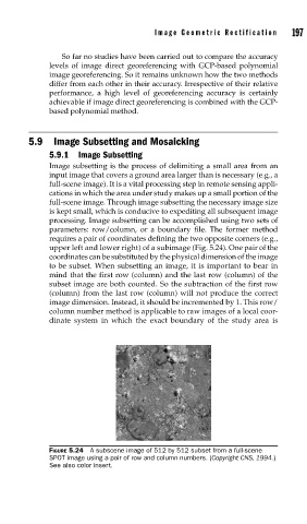
Image Geometric Rectification      197

                   So far no studies have been carried out to compare the accuracy
               levels of image direct georeferencing with GCP-based polynomial
               image georeferencing. So it remains unknown how the two methods
               differ from each other in their accuracy. Irrespective of their relative
               performance, a high level of georeferencing accuracy is certainly
               achievable if image direct georeferencing is combined with the GCP-
               based polynomial method.


          5.9  Image Subsetting and Mosaicking

               5.9.1 Image Subsetting
               Image subsetting is the process of delimiting a small area from an
               input image that covers a ground area larger than is necessary (e.g., a
               full-scene image). It is a vital processing step in remote sensing appli-
               cations in which the area under study makes up a small portion of the
               full-scene image. Through image subsetting the necessary image size
               is kept small, which is conducive to expediting all subsequent image
               processing. Image subsetting can be accomplished using two sets of
               parameters: row/column, or a boundary file. The former method
               requires a pair of coordinates defining the two opposite corners (e.g.,
               upper left and lower right) of a subimage (Fig. 5.24). One pair of the
               coordinates can be substituted by the physical dimension of the image
               to be subset. When subsetting an image, it is important to bear in
               mind that the first row (column) and the last row (column) of the
               subset image are both counted. So the subtraction of the first row
               (column) from the last row (column) will not produce the correct
               image dimension. Instead, it should be incremented by 1. This row/
               column number method is applicable to raw images of a local coor-
               dinate system in which the exact boundary of the study area is


               FIGURE 5.24  A subscene image of 512 by 512 subset from a full-scene
               SPOT image using a pair of row and column numbers. (Copyright CNS, 1994.)
               See also color insert.