
Page 308 - Materials Chemistry, Second Edition
P. 308
L1644_C07.fm Page 280 Monday, October 20, 2003 12:10 PM
Rural/Rural
Agglomerated/Rural
Lleida
Girona
Agglomerated/Urban
Barcelona
Region class/District class
Tarragona
Rural/Central city
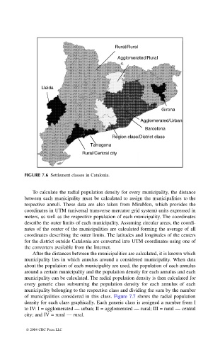
FIGURE 7.6 Settlement classes in Catalonia.
To calculate the radial population density for every municipality, the distance
between each municipality must be calculated to assign the municipalities to the
respective annuli. These data are also taken from MiraMon, which provides the
coordinates in UTM (universal transverse mercator grid system) units expressed in
meters, as well as the respective population of each municipality. The coordinates
describe the outer limits of each municipality. Assuming circular areas, the coordi-
nates of the center of the municipalities are calculated forming the average of all
coordinates describing the outer limits. The latitudes and longitudes of the centers
for the district outside Catalonia are converted into UTM coordinates using one of
the converters available from the Internet.
After the distances between the municipalities are calculated, it is known which
municipality lies in which annulus around a considered municipality. When data
about the population of each municipality are used, the population of each annulus
around a certain municipality and the population density for each annulus and each
municipality can be calculated. The radial population density is then calculated for
every generic class subsuming the population density for each annulus of each
municipality belonging to the respective class and dividing the sum by the number
of municipalities considered in this class. Figure 7.7 shows the radial population
density for each class graphically. Each generic class is assigned a number from I
to IV: I = agglomerated — urban; II = agglomerated — rural; III = rural — central
city; and IV = rural — rural.
© 2004 CRC Press LLC