Page 320 - Laboratory Manual in Physical Geology
P. 320

Drainage basin of the Mississippi River
                                                                       Mts.
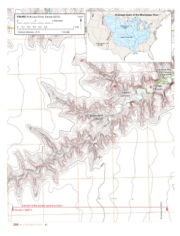
             FIGURE 11.4: Lake Scott, Kansas (2012)   North
                                                                       Rocky
             0          .5          1 kilometer
             0  0.1  0.2  0.3  0.4  0.5            1 mile                          Mississippi
                                                                                     River
             Contour interval = 10 ft.     1:24,000
                                                                            Mts.
                                                                          Rocky    Lake Scott, KS

                                                                  Continental
                                                                   Divide


                                                        A


                                                                               B                       D


                          C


                                                                                                               (Courtesy of USGS)
                Gradient of the ancient upland surface
         A elevation 3080 ft                                                                                      B


          290  ■  L ABOR ATORY  11
   315   316   317   318   319   320   321   322   323   324   325