
Page 347 - Laboratory Manual in Physical Geology
P. 347
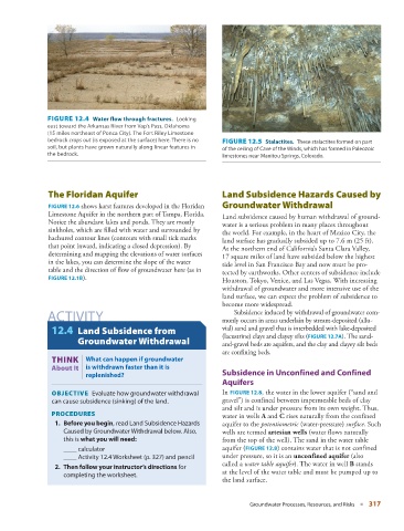
FIGURE 12.4    Water flow through fractures.          Looking
               east toward the Arkansas River from Vap’s Pass, Oklahoma
               (15 miles northeast of Ponca City). The Fort Riley Limestone
               bedrock  crops out  (is exposed at the surface) here. There is no     FIGURE 12.5    Stalactites.          These stalactites formed on part
               soil, but plants have grown naturally along linear features in   of the ceiling of Cave of the Winds, which has formed in Paleozoic
               the bedrock.                                         limestones near Manitou Springs, Colorado.


                    The Floridan Aquifer                                Land Subsidence Hazards Caused by


                   FIGURE  12.6  shows karst features developed in the Floridan   Groundwater Withdrawal

                Limestone Aquifer in the northern part of Tampa, Florida.     Land subsidence caused by human withdrawal of ground-
                Notice the abundant lakes and ponds. They are mostly   water is a serious problem in many places throughout
                sinkholes, which are filled with water and surrounded by   the world. For example, in the heart of Mexico City, the
                hachured contour lines (contours with small tick marks   land surface has gradually subsided up to 7.6 m (25 ft).
                that point inward, indicating a closed depression). By   At the northern end of California’s Santa Clara Valley,
                determining and mapping the elevations of water surfaces   17 square miles of land have subsided below the highest
                in the lakes, you can determine the slope of the water   tide level in San Francisco Bay and now must be pro-
                table and the direction of flow of groundwater here (as in   tected by earthworks. Other centers of subsidence include
                  FIGURE  12.1B   ).                                Houston, Tokyo, Venice, and Las Vegas. With increasing

                                                                    withdrawal of groundwater and more intensive use of the
                                                                    land surface, we can expect the problem of subsidence to
                                                                    become more widespread.
                                                                          Subsidence induced by withdrawal of ground water com-
                ACTIVITY                                            monly occurs in areas underlain by stream-deposited (allu-

                   12.4   Land Subsidence from                      vial) sand and gravel that is interbedded with lake-deposited
                                                                    (lacustrine) clays and clayey silts (  FIGURE   12.7A   ). The sand-
                         Groundwater Withdrawal                     and-gravel beds are aquifers, and the clay and clayey silt beds

                       THINK |  What can happen if  ground water    are confining beds.
                 About It  is withdrawn faster than it is
                           replenished?                                  Subsidence in Unconfined and Confined
                                                                    Aquifers


                   OBJECTIVE    Evaluate how groundwater withdrawal    In  FIGURE  12.8 , the water in the lower aquifer (“sand and

                 can cause subsidence (sinking) of the land.        gravel”) is confined between impermeable beds of clay
                                                                    and silt and is under pressure from its own weight. Thus,
                   PROCEDURES                                       water in wells  A  and  C  rises naturally from the confined
                      1.     Before you begin , read Land Subsidence Hazards   aquifer to the  potentiometric  (water-pressure)  surface . Such
                    Caused by Groundwater Withdrawal below. Also,   wells are termed  artesian wells  (water flows naturally
                    this is  what you will need :                   from the top of the well). The sand in the water table


                       ____  calculator                             aquifer (  FIGURE  12.8 ) contains water that is not confined

                      ____  Activity 12.4 Worksheet (p.  327 ) and pencil      under pressure, so it is an  unconfined aquifer  (also

                                                                    called a  water table aquifer )  The water in well  B  stands
                                                                                           .
                     2.     Then follow your instructor’s directions  for
                    completing the worksheet.                       at the level of the water table and must be pumped up to
                                                                    the land surface.
                                                                             Groundwater Processes, Resources, and Risks   ■  317