
Page 344 - Laboratory Manual in Physical Geology
P. 344
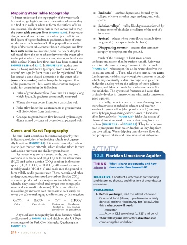
Mapping Water Table Topography                        ■    ( Sinkholes )—surface depressions formed by the
          To better understand the topography of the water table   collapse of caves or other large underground void
        in a region, geologists measure its elevation wherever they   spaces.
        can find it in wells or where it forms the surfaces of lakes      ■    ( Solution valleys )—valley-like depressions formed by
        and streams. The elevation data is then contoured to map   a linear series of sinkholes or collapse of the roof of a
        the  water table contour lines  (  FIGURE  12.1B   ). Since water   linear cave.

        always flows down the shortest and steepest path it can
        find (path of highest hydraulic gradient), a drop of water      ■    ( Springs )—places where water flows naturally from
        on the water table surface will flow perpendicular to the   the ground (from spaces in the bedrock).
        slope of the water table contour lines. Geologists use  flow      ■    ( Disappearing streams )—streams that terminate
        lines with arrows  to show the paths that water droplets   abruptly by seeping into the ground.
        will travel from the point where they enter the water table
        to the point where they reach a lake, stream, or level water     Much of the drainage in karst areas occurs
        table surface. Notice how flow lines have been plotted on     underground rather than by surface runoff. Rainwater


          FIGURES  12.1B    and  12.1C   . In  FIGURE  12.1C   , notice how   seeps into the ground along fractures in the bedrock


        water is being withdrawn (pumped) from a well in an   (  FIGURE  12.4 ), whereupon the acidic water dissolves the

        unconfined aquifer faster than it can be replenished. This   limestone around it. The cracks widen into narrow  caves
        has caused a cone-shaped depression in the water table   (underground cavities large enough for a person to enter),
        ( cone of depression ) and a change in the regional flow   which may eventually widen into huge cave galleries.
        of the groundwater. Thus, water table contour maps are   Sinkholes develop where the ceilings of these galleries
          useful for determining the following:              collapse, and lakes or ponds form wherever water fills
                                                             the sinkholes. The systems of fractures and caves that

             ■   Paths of groundwater flow (flow lines on a map), along   typically develop in limestones are what make limestones
            which hydraulic gradients are normally measured
                                                             good aquifers.
            ■   Where the water comes from for a particular well         Eventually, the acidic water that was  dissolving  lime-

                                                             stone becomes so enriched in calcium and bicarbon-

            ■   Paths (flow lines) that contaminants in groundwater   ate that it turns alkaline (the opposite of acid) and may
            will likely follow from their source
                                                               actually begin  precipitating  calcite. Caves in karst areas
            ■   Changes to groundwater flow lines and hydraulic gra-  often have  stalactites  (  FIGURE  12.5   ), icicle-like masses of


            dients caused by cones of depression at pumped wells           chemical limestone made of calcite that hang from cave
                                                             ceilings (  FIGURE  12.5     and  FIGURE   6.8    ). They form because

                                                             calcite precipitates from water droplets as they drip from
            Caves and Karst Topography                       the cave ceiling. Water dripping onto the cave floor also
          The term  karst  describes a distinctive topography that   can precipitate calcite and form more stout  stalagmites.
        indicates dissolution of underlying soluble rock, gener-

        ally limestone (  FIGURE  12.2 ). Limestone is mostly made of


        calcite (a carbonate mineral), which dissolves when it reacts
        with acidic rainwater and shallow groundwater.        ACTIVITY
                Rainwater may contain several acids, but the most     12.3  Floridan Limestone Aquifer
        common is carbonic acid (H  CO  ). It forms when water
                               2   3
        (H  O) and carbon dioxide (CO  ) combine in the atmo-
           2                      2
        sphere (H  O     +     CO       =     H  CO  ). All natural rainwater         THINK |  What is karst topography and how
                2        2     2   3
        is mildly acidic (pH of 5–6) and soaks into the ground to   About It  does water flow beneath it?
        form mildly acidic groundwater. There, bacteria and other
        underground organisms produce carbon dioxide (CO  )     OBJECTIVE    Construct a water table contour map
                                                    2
        as a waste product of their respiration (metabolic process   and determine the rate and direction of groundwater
        whereby they convert food and oxygen into energy, plus   movement.
        water and carbon dioxide waste). This carbon dioxide
        makes the groundwater even more acidic, so it easily dis-    PROCEDURES
        solves the calcite making up the limestone by this reaction:        1.     Before you begin , read the Introduction and
                                                                  Caves and Karst (above, if you have not already
                                                     -1
             CaCO   +  H CO   =  Ca    +2   +  2HCO               done so) and the Floridan Aquifer (below). Also,
                                                     3
               3
                             3
                         2
           Calcite    Carbonic acid   Calcium ions    Bicarbonate   this is  what you will need :
                                   dissolved in   ions dissolved
                                   groundwater in groundwater        ___ calculator
              A typical karst topography has these features, which     ___ Activity 12.3 Worksheet (p.  325 ) and pencil
        are illustrated in   FIGURE  12.2  and visible on the US Topo       2.     Then follow your instructor’s directions  for


        orthoimage of the Park City, Kentucky Quadrangle in       completing the worksheet.
          FIGURE  12.3   .

        314  ■  L ABOR ATORY  12