
Page 214 - MATLAB Recipes for Earth Sciences
P. 214
8.6 Digitizing from the Screen 209
Georeferenced ASTER Image
0.4
0.5
0.6
Latitude
0.7
0.8
0.9
36.1 36.2 36.3 36.4 36.5 36.6 36.7
Longitude
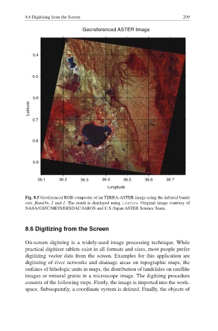
Fig. 8.5 Geoferenced RGB composite of an TERRA-ASTER image using the infrared bands
vnir_Band3n, 2 and 1. The result is displayed using imshow. Original image courtesy of
NASA/GSFC/METI/ERSDAC/JAROS and U.S./Japan ASTER Science Team.
8.6 Digitizing from the Screen
On-screen digitzing is a widely-used image processing technique. While
practical digitizer tablets exist in all formats and sizes, most people prefer
digitizing vector data from the screen. Examples for this application are
digitizing of river networks and drainage areas on topographic maps, the
outlines of lithologic units in maps, the distribution of landslides on satellite
images or mineral grains in a microscope image. The digitzing procedure
consists of the following steps. Firstly, the image is imported into the work-
space. Subsequently, a coordinate system is defined. Finally, the objects of