
Page 38 - Pipeline Rules of Thumb Handbook
P. 38
General Information 25
How to read land descriptions
A land description is a description of a tract of land, in
legally acceptable terms, that defines exactly where the tract
of land is located and how many acres it contains.
Table 1
Land Measurements
Linear Measure
1 inch 0.833 feet 16 1/2 feet 1 rod
7.92 inches 1 link 5 1/2 yards 1 rod
12 inches 1 foot 4 rods 1 link
1 vara 33 inches 66 feet 1 chain
Figure 1
2 3/4 feet 1 vara 80 chains 1 mile
3 feet 1 yard 320 rods 1 mile
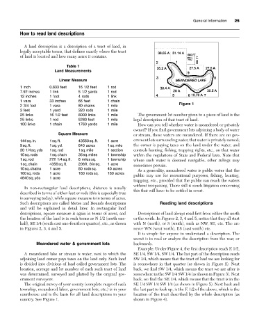
25 links 16 1/2 feet 8000 links 1 mile The government lot number given to a piece of land is the
25 links 1 rod 5280 feet 1 mile legal description of that tract of land.
100 links 1 chain 1760 yards 1 mile How can you tell whether water is meandered or privately
owned? If you find government lots adjoining a body of water
Square Measure or stream, those waters are meandered. If there are no gov-
144sq.in. 1sq.ft. 43560sq.ft. 1 acre ernment lots surrounding water, that water is privately owned;
9sq.ft. 1sq.yd. 640 acres 1sq.mile the owner is paying taxes on the land under the water, and
30 1/4sq.yds 1sq.rod 1sq.mile 1 section controls hunting, fishing, trapping rights, etc., on that water
10sq.rods 1sq.chain 36sq.miles 1 township within the regulations of State and Federal laws. Note that
1sq.rod 272 1/4sq.ft. 6 milessq. 1 township where such water is deemed navigable, other rulings may
1sq.chain 4356sq.ft. 208ft. 8insq. 1 acre sometimes pertain.
10sq.chains 1 acre 80 rodssq. 40 acres As a generality, meandered water is public water that the
160sq.rods 1 acre 160 rodssq. 160 acres public may use for recreational purposes, fishing, hunting,
4840sq.yds 1 acre
trapping, etc., provided that the public can reach the waters
without trespassing. There still is much litigation concerning
In non-rectangular land descriptions, distance is usually
this that will have to be settled in court.
described in terms of either feet or rods (this is especially true
in surveying today), while square measure is in terms of acres.
Such descriptions are called Metes and Bounds descriptions Reading land descriptions
and will be explained in detail later. In rectangular land
descriptions, square measure is again in terms of acres, and Descriptions of land always read first from either the north
the location of the land is in such terms as N 1/2 (north one- or the south. In Figures 2, 3, 4 and 5, notice that they all start
half), SE 1/4 (south east one-fourth or quarter), etc., as shown with N (north), or S (south), such as NW, SE, etc. The are
in Figures 2, 3, 4 and 5. never WN (west north), ES (east south) etc.
It is simple for anyone to understand a description. The
secret is to read or analyze the description from the rear, or
Meandered water & government lots backwards.
Example: Under Figure 4, the first description reads E 1/2,
A meandered lake or stream is water, next to which the SE 1/4, SW 1/4, SW 1/4. The last part of the description reads
adjoining land owner pays taxes on the land only. Such land SW 1/4, which means that the tract of land we are looking for
is divided into divisions of land called government lots. The is somewhere in that quarter (as shown in Figure 2). Next
location, acreage and lot number of each such tract of land back, we find SW 1/4, which means the tract we are after is
was determined, surveyed and platted by the original gov- somewhere in the SW 1/4 SW 1/4 (as shown in Figure 3). Next
ernment surveyors. back, we find the SE 1/4, which means that the tract is in the
The original survey of your county (complete maps of each SE 1/4 SW 1/4 SW 1/4 (as shown in Figure 5). Next back and
township, meandered lakes, government lots, etc.) is in your the last part to look up, is the E 1/2 of the above, which is the
courthouse and is the basis for all land descriptions in your location of the tract described by the whole description (as
country. See Figure 1. shown in Figure 4).