
Page 332 - Volcano and Geothermal Tourism
P. 332
308 Oceania
Western Plains – ‘We now travelled over a country
quite open, slightly undulating and well-covered
with grass . . . vast plains, fringed with forests and
embellished with lakes . . . the open plains extended
as far as the eye could reach’ (Mitchell, 1838).
In the 1840s and 1850s several books and
scientific journal articles made the area widely
known, at a time when popular interest in volcanoes
was growing. James Bonwick, an inspector of
schools, recorded his observations of western
Victoria and many of its geological features in a
book published in 1858, and in 1866 he compared
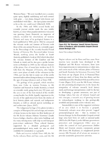
the volcanic rocks and features of Victoria with Figure 20.4 Old ‘bluestone’ (basalt) Volcano Discovery
those of the area around Rome, in a scientific paper Centre at Penshurst, with Kanawinka Geopark Director
in the Proceedings of the recently founded Royal Joanne McKnight (left)
Society of Victoria. The Reverend Julian Tenison Source: Photo courtesy of Chris Pavich
Woods, working across the border in South
Australia, published a book in 1862 which described
the volcanic features of Mt Gambier and Mt Napier volcano and its flows and lava caves. New
Schank in detail, and he also gave a public lecture reserves have recently been developed at Mt
series in Portland in 1865 on the volcanic features Elephant and Mt Rouse volcanoes, there have
of the plains. One of many later workers was E. D. been improvements to interpretation at other sites,
Gill, from the Museum of Victoria, who helped and across much of the volcanic plains of Victoria
start a new phase of study of the volcanoes in the and South Australia the Volcanoes Discovery Trail
1960s, and was the first to make use of the newly has been set up (Figure 20.4). A National Trust
invented radiocarbon dating technique to determine landscape study of Stony Rise lava flows, and the
the ages of young volcanoes such as Tower Hill. establishment of the Penshurst Volcanoes Discovery
The geology of the geopark, which stretches Centre (Figure 20.4), near the Mt Rouse volcano,
from near Colac in western Victoria, to Mt are also promising developments. In the future the
Gambier and beyond in South Australia, is based integration of volcanic research, local history
on scientific study going back over 150 years, and study, and heritage interpretation could be the key
the area is one of the best studied of the world’s to developing a greater awareness, not just of
young basaltic lava fields. Equally important to the heritage values, but also of volcanic hazard and
success of the application have been the studies of risk concepts, a research area of growing interest
local history, plants and animals, and indigenous to volcanologists working in this geologically
features, as well as cultural aspects including art youthful and potentially active volcanic area.
and architecture (Joyce, 2007). Sustainability is one of the suggested attributes
The indigenous heritage of the plains includes a of an area which is to become a geopark.
complex of Aboriginal fish and eel traps, and remains Fortunately volcanic areas often provide ‘rugged’
of stone houses, in the stony rise flow landscapes of geomorphological sites – that is, resistent to
the Mt Eccles volcano. Historic ‘bluestone’ (basalt) human damage. In the Kanawinka Geopark several
houses, bridges, churches, other town buildings and large areas have been set aside as national parks
the many striking stone walls help record European (Mt Eccles, Mt Napier), under full state government
post-contact settlement. These cultural features, protection and management. Other areas are
supported by a detailed geological and under the control of local government (Bullen
geomorphological story, made the area an ideal Merri and Gnotuk craters), community groups
candidate for nomination as a geopark. (Mt Leura, Mt Elephant), or enlightened private
Parks and reserves include Tower Hill, the Mt owners (Mt Noorat), all of whom are anxious to
Eccles volcano, flows and lava caves, and the Mt provide sustainable geotourism activities.
Ch20.indd 308 4/7/2010 12:21:53 PM