Page 389 - Laboratory Manual in Physical Geology
P. 389

BIG IDEAS                           PRE-LAB VIDEO

                                                                      Drylands are lands of arid-to-dry, subhumid climates
                                                                    that generally have sparse vegetation and receive
                                                                    precipitation just a few days or one season of the year.
                                                                    Even so, water is one of the primary agents that produces
                                                                    characteristic dryland landforms and flood hazards.
                                                                    Wind is also a factor in the erosion and transportation
                                                                    of sediment, especially dust and the sand that makes
                                                                    dunes. Although many people live in drylands, true
                                                                    deserts do not support any agriculture without irrigation
                                                                    or a well.


                                                                      FOCUS YOUR INQUIRY

                                                                           |
                                                                         THINK What are some characteristic processes,
                                                                    About It  landforms, and hazards of drylands?
                                                                          ACTIVITY 14.1 Dryland Inquiry   (p.  358 )


                                                                           |
                                                                         THINK  What can we learn from topographic maps and
                                                                    About It    satellite images about dryland processes and
                                                                             landforms?
                                                                          ACTIVITY 14.2  Mojave Desert, Death Valley,
                                                                                 California     (p.  358 )

                                                                          ACTIVITY 14.3  Sand Seas of Nebraska and the Arabian
                                                                                 Peninsula     (p.  363 )
                                                                           |
                                                                         THINK  How can topographic maps and aerial
                                              14                          ACTIVITY 14.4 Dryland Lakes of Utah   (p.  365 )
                                                                    About It  photographs of drylands be used to interpret
                                                                             how their environments have changed?


                L ABOR A T OR Y
                                                                           Introduction
                Dryland                                                Drylands  are lands in arid, semi-arid, and dry-sub-humid
                                                                    climates. The United Nations Environment Programme
                                                                    (UNEP) estimates that drylands make up 41% of all land on
               Landforms,                                           Earth and that they support one-third of the world’s human
                                                                    population. Sixteen percent of all existing drylands (about 6%
               Hazards, and Risks                                   of all land areas on Earth) are so dry that their biological pro-
                                                                    ductivity is too poor to support any type of agriculture (unless
                                                                    irrigation or wells are used). These regions are true  deserts  .
                         C ONTRIBUTING   A UTHORS                         When people rely on land for farming or ranching,
                                                                    they must assess the potential for  land degradation —a state
                   Charles G. Oviatt   •    Kansas State University
                  James B. Swinehart   •     Institute of Agriculture & Natural Resources,   of declining agricultural productivity due to natural and/
                               University of Nebraska               or human causes. Humid lands (lands in humid climates)
                                                                    may undergo degradation from factors such as soil  erosion
                  James R. Wilson   •    Weber State University
                                                                    (wearing away), farming without crop rotation or fertilization,
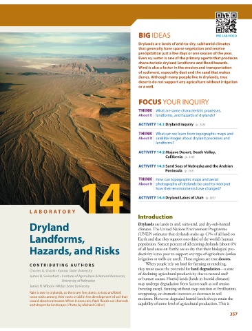
               Rain is rare in drylands, so there are few plants to trap and bind   overgrazing, or dramatic increases or decreases in soil
               loose rocks among their roots or aid in the development of soil that   moisture. However, degraded humid lands always retain the
               would absorb rainwater. When it does rain, flash floods cut channels
               and shape the landscape. (Photo by Michael Collier)  capability of some level of agricultural production. This is
                                                                                                                 357
   384   385   386   387   388   389   390   391   392   393   394