
Page 207 - Fundamentals of Ocean Renewable Energy Generating Electricity From The Sea
P. 207
196 Fundamentals of Ocean Renewable Energy
8.1.3 Sources of Data
As mentioned in the introduction to this chapter, a model is only as good as
the data that is used as model input. In addition, data are essential for model
validation, which provides confidence in model performance. Model validation
is covered in detail in Section 8.5. The main types of data, described in this
section, are coastline and bathymetry data, used to set up model bathymetry and
mesh, boundary condition data (e.g. astronomical tides), and surface fields such
as wind stress and atmospheric pressure.
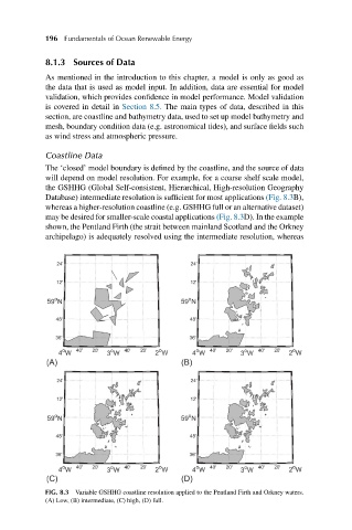
Coastline Data
The ‘closed’ model boundary is defined by the coastline, and the source of data
will depend on model resolution. For example, for a coarse shelf scale model,
the GSHHG (Global Self-consistent, Hierarchical, High-resolution Geography
Database) intermediate resolution is sufficient for most applications (Fig. 8.3B),
whereas a higher-resolution coastline (e.g. GSHHG full or an alternative dataset)
may be desired for smaller-scale coastal applications (Fig. 8.3D). In the example
shown, the Pentland Firth (the strait between mainland Scotland and the Orkney
archipelago) is adequately resolved using the intermediate resolution, whereas
FIG. 8.3 Variable GSHHG coastline resolution applied to the Pentland Firth and Orkney waters.
(A) Low, (B) intermediate, (C) high, (D) full.