
Page 160 - Geochemical Anomaly and Mineral Prospectivity Mapping in GIS
P. 160
Analysis of Geologic Controls on Mineral Occurrence 161
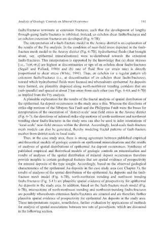
faults/fractures terminate at extension fractures, such that the development of lengthy
through-going faults/fractures is inhibited. Instead, en echelon shear faults/fractures and
en echelon extension fractures are developed (Fig. 6-7B).
The interpretation of a fault-fracture model in the Aroroy district is an explanation of
the results of the Fry analysis. In the condition of near-field stress depicted in the fault-
fracture mesh model in the Aroroy district (Fig. 6-7B), hydrothermal fluids (that brought
about, say, epithermal mineralisations) were re-distributed towards the extension
faults/fractures. This interpretation is supported by the knowledge that (a) shear stresses
[i.e., ½(σ 1-σ 3)] are highest at discontinuities or tips of en echelon shear faults/fractures
(Segall and Pollard, 1980) and (b) rate of fluid flow (or strain rate) is directly
proportional to shear stress (White, 1991). Thus, en echelon (or a regular pattern of)
extension faults/fractures (i.e., at discontinuities of en echelon shear faults/fractures),
toward which hydrothermal fluids were focused and whereabouts epithermal Au deposits
were formed, are plausibly disposed along north-northwest trending corridors that are
(sub-)parallel and spaced at about 2 km away from each other (see Figs. 6-6A and 6-7B)
as implied from the Fry analysis.
A plausible explanation for the results of the fractal analysis of spatial distribution of
the epithermal Au deposit occurrences in the study area is this. Whereas the directions of
strike-slip motions of the Sibuyan Sea Fault and the Philippine Fault were the bases for
interpretation of the orientation of ‘district-scale’ near-field stress in the Aroroy district
(Fig. 6-7), the directions of inferred strike-slip motions of north-northwest and northwest
trending shear faults/fractures in the study area can also be used to infer orientations of
‘local-scale’ near-field stresses within the district. Accordingly, local-scale fault-fracture
mesh models can also be generated, thereby modeling fractal patterns of fault-fracture
meshes from district scale to local scale.
Thus, in the case study area, there is strong agreement between published empirical
and theoretical models of geologic controls on epithermal mineralisations and the results
of analyses of spatial distributions of epithermal Au deposit occurrences. Syntheses of
published empirical and theoretical models of geologic controls on mineralisation and
results of analyses of the spatial distribution of mineral deposit occurrences therefore
provide insights to certain geological features that are spatial evidence of prospectivity
for mineral deposits of the type sought. Accordingly, based on the observed geological
characteristics of the epithermal Au deposits in the case study area (see Chapter 3), the
results of analyses of the spatial distribution of the epithermal Au deposits and the fault-
fracture mesh model (Fig. 6-7B), north-northwest trending and northwest trending
faults/fractures (Fig. 5-13) are plausible spatial evidence of prospectivity for epithermal
Au deposits in the study area. In addition, based on the fault-fracture mesh model (Fig.
6-7B), intersections of north-northwest trending and northwest-trending faults/fractures
are possibly whereabouts extension faults/fractures are situated and are therefore further
plausible spatial evidence of prospectivity for epithermal Au deposits in the study area.
These interpretations require, nonetheless, further evaluation by applications of methods
for analysis of spatial associations between two sets of geo-objects, which are discussed
in the following section.