
Page 222 - Geochemical Remote Sensing of The Sub-Surface
P. 222
198 V.T. Jones, M.D. Matthews and D. Richers
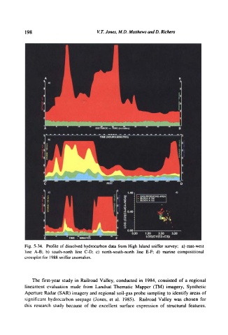
Fig. 5-34. Profile of dissolved hydrocarbon data from High Island sniffer survey; a) east-west
line A-B; b) south-north line C-D; c) north-south-north line E-F; d) marine compositional
crossplot for 1988 sniffer anomalies.
The first-year study in Railroad Valley, conducted in 1984, consisted of a regional
lineament evaluation made from Landsat Thematic Mapper (TM) imagery, Synthetic
Aperture Radar (SAR) imagery and regional soil-gas probe sampling to identify areas of
significant hydrocarbon seepage (Jones, et al. 1985). Railroad Valley was chosen for
this research study because of the excellent surface expression of structural features,