
Page 226 - Geochemical Remote Sensing of The Sub-Surface
P. 226
202 Y.T. Jones, M.D. Matthews and D. Richers
1
Mapped Photolinears, Currant Detail Area, [
Railroad Valley, Nye County, Nevada /
~~, /f/ ~ ./~.//.~~---/ ~ .. / Y //
/
/
/ -- . ' ..OS_ /
"" " ~'////" ' S/.L~" I
J ~ S x " - , '
'
~\ ~~ ,/.- /" / -,- //'/ /" "~ !------ ;
"~ "Z / / /
7/ .... ,
, i/,'i t_.- ,
l" /i ~ f- i
" -'- -z~j_..~~,
t
" N
'4
/'i L~/1 , LEGEND
t',?,, beach ,
/ /_ >//~ I C~--, possible fault
/,I / down $1de)
J _ t 0 I Mi
9 0 1 Km
__ ,. t ~ J ~
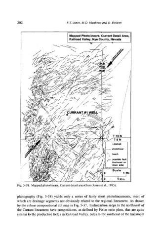
Fig. 5-38. Mapped photolinears, Currant detail area (from Jones et al., 1985).
photography (Fig. 5-38) yields only a series of fairly short photolineaments, most of
which are drainage segments not obviously related to the regional lineament. As shown
by the colour compositional dot map in Fig. 5-37, hydrocarbon seeps to the northwest of
the Currant lineament have compositions, as defined by Pixler ratio plots, that are quite
similar to the productive fields in Railroad Valley. Sites to the southeast of the lineament