
Page 238 - Geology of Carbonate Reservoirs
P. 238
DEPOSITIONAL RESERVOIRS 219
ates salt ridge growth history by studying interval isopach maps to locate thin zones
in the overlying Buckner Formation. These thins indicate that the paleostructural
crests were high at the time of Buckner deposition. Elongate paleostructural highs
at this dip position on the platform have a strong chance of being blanketed by
grainstone deposits. At first, drilling along structural trends seems to be no more
sophisticated than drilling a group of structural anomalies. It is more than that
because the structural crests had to be high enough at the time of Smackover depo-
sition to have been washed by fair - weather waves and currents that helped form
and accumulate coated grains. Salt structures that formed later would not have been
in the zone of grainstone formation. Structures that formed too early may have
continued to grow through the depth favorable for grainstone deposition to become
piercement domes or diapirs on which there was no Smackover deposition. Clearly,
just any structural crest is not enough. It must be a paleostructural crest that was in
the right water depths of the Smackover sea at the right time for grainstone deposi-
tion, for burial before extensive cementation, and for preservation of depositional
porosity to exist, only to be enlarged by later burial dissolution.
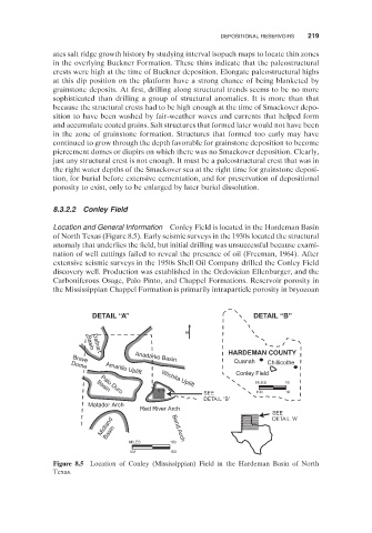
8.3.2.2 Conley Field
Location and General Information Conley Field is located in the Hardeman Basin
of North Texas (Figure 8.5 ). Early seismic surveys in the 1930s located the structural
anomaly that underlies the field, but initial drilling was unsuccessful because exami-
nation of well cuttings failed to reveal the presence of oil (Freeman, 1964 ). After
extensive seismic surveys in the 1950s Shell Oil Company drilled the Conley Field
discovery well. Production was established in the Ordovician Ellenburger, and the
Carboniferous Osage, Palo Pinto, and Chappel Formations. Reservoir porosity in
the Mississippian Chappel Formation is primarily intraparticle porosity in bryozoan
DETAIL “A” DETAIL “B”
N
Basin
HARDEMAN COUNTY
Dalhart
Brave Anadarko Basin
Quanah Chillicothe
Dome Amarillo Uplift
Conley Field
MILES 10
Wichita Uplift
Basin
SEE KM 16
Palo Duro
DETAIL “B”
Matador Arch
Red River Arch
SEE
DETAIL “A”
Midland Basin Bend Arch
MILES 100
KM 160
Figure 8.5 Location of Conley (Mississippian) Field in the Hardeman Basin of North
Texas.