
Page 136 - Introduction to Mineral Exploration
P. 136
6: REMOTE SENSING 119
1 2 3 4 5 6
(a)
Coverage of
single photo 60%
overlap
Stereoscopic
(b) overlap area
1 2 4 5 6
3
Nadir line Edge variations
(ground trace of aircraft) caused by aircraft drift
(c)
Flight line
30% Sidelap
Sidelap
Aircraft drift
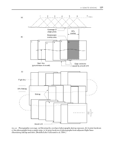
FIG. 6.8 Photographic coverage. (a) Showing the overlap of photographs during exposure. (b) A print laydown
of the photographs from a single strip. (c) A print laydown of photographs from adjacent flight lines
illustrating sidelap and drift. (Modified after Lillesand et al. 2004.)