
Page 220 - Petroleum Geology
P. 220
197
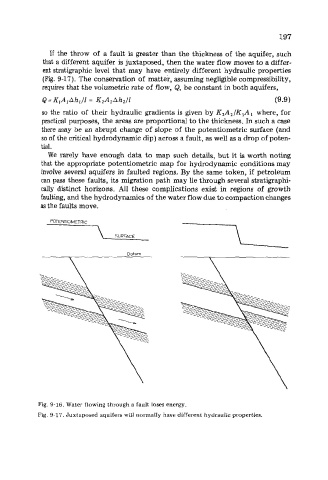
If the throw of a fault is greater than the thickness of the aquifer, such
that a different aquifer is juxtaposed, then the water flow moves to a differ-
ent stratigraphic level that may have entirely different hydraulic properties
(Fig. 9-17). The conservation of matter, assuming negligible compressibility,
requires that the volumetric rate of flow, Q, be constant in both aquifers,
Q = K,A,Ah,/l = K,A,Ah,/l (9 -9 1
so the ratio of their hydraulic gradients is given by K,A2/KlA1 where, for
practical purposes, the areas are proportional to the thickness. In such a case
there may be an abrupt change of slope of the potentiometric surface (and
so of the critical hydrodynamic dip) across a fault, as well as a drop of poten-
tial.
We rarely have enough data to map such details, but it is worth noting
that the appropriate potentiometric map for hydrodynamic conditions may
involve several aquifers in faulted regions. By the same token, if petroleum
can pass these faults, its migration path may lie through several stratigraphi-
cally distinct horizons. All these complications exist in regions of growth
faulting, and the hydrodynamics of the water flow due to compaction changes
as the faults move.
POTENTIOMETRIC
SURFACE
Fig. 9-16. Water flowing through a fault loses energy.
Fig. 9-17. Juxtaposed aquifers will normally have different hydraulic properties.