
Page 36 - The Petroleum System From Source to Trap
P. 36
28 Smith
A
ATLANTIC OCEAN
RESULTS Of 1968
OFFSHORE TEXAS SALE
FIEPORTEO IN 1975
TRACTS LEASED - 110
TRACTS RELIHQI.JSHED - 92.5
TRACTS PRODUCTIVE - 6 -
ALL ARE GAS�
PRE 1968 DISCOVERIES <:=: BALTIMORE CANYON
,......, ,......, MAJOR FAlA..T TREMJS O.C.S., SALE 40 A ' ..l2!L....
SEPT. 1, 1976 D AREA OFFERED
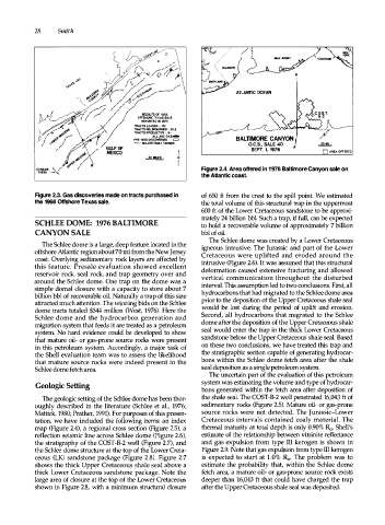
Figure 2.4. Area offered in 1976 Baltimore Canyon sale on
the Atlantic coast.
Figure 2.3. Gas discoveries made on tracts purchased in of 650 ft from the crest to the spill point. We estimated
the 1968 Offshore Texas sale. the total volume of this structural trap in the uppermost
600 ft of the Lower Cretaceous sandstone to be approxi
mately 24 billion bbl. Such a trap, if full, can be expected
SCHLEE DOME: 1976 BALTIMORE to hold a recoverable volume of approximately 7 billion
CANYON SALE bbl of oil.
The Schlee dome was created by a Lower Cretaceous
The Schlee dome is a large, deep feature located in the igneous intrusive. The Jurassic and part of the Lower
offshore Atlantic region about 70 mi from the New Jersey Cretaceous were uplifted and eroded around the
coast. Overlying sedimentary rock layers are affected by intrusive (Figure 2.6). It was assumed that this structural
this feature. Presale evaluation showed excellent deformation caused extensive fracturing and allowed
reservoir rock, seal rock, and trap geometry over and
around the Schlee dome. One trap on the dome was a vertical communication throughout the disturbed
simple domal closure with a capacity to store about 7 interval. This assumption led to two conclusions. First, all
billion bbl of recoverable oil. Naturally a trap of this size hydrocarbons that had migrated to the Schlee dome area
attracted much attention. The winning bids on the Schlee prior to the deposition of the Upper Cretaceous shale seal
dome tracts totaled $544 million (West, 1976). Here the would be lost during the period of uplift and erosion.
Schlee dome and the hydrocarbon generation and Second, all hydrocarbons that migrated to the Schlee
migration system that feeds it are treated as a petroleum dome after the deposition of the Upper Cretaceous shale
system. No hard evidence could be developed to show seal would enter the trap in the thick Lower Cretaceous
that mature oil- or gas-prone source rocks were present sandstone below the Upper Cretaceous shale seal. Based
in this petroleum system. Accordingly, a major task of on these two conclusions, we have treated this trap and
the Shell evaluation team was to assess the likelihood the stratigraphic section capable of generating hydrocar
that mature source rocks were indeed present in the bons within the Schlee dome fetch area after the shale
Schlee dome fetch area. seal deposition as a single petroleum system.
The uncertain part of the evaluation of this petroleum
system was estimating the volume and type of hydrocar
Geologic Setting
bons generated within the fetch area after deposition of
The geologic setting of the Schlee dome has been thor the shale seal. The COST-B-2 well penetrated 16,043 ft of
oughly described in the literature (Schlee et al., 1976; sedimentary rocks (Figure 2.5). Mature oil- or gas-prone
Mattick, 1980; Prather, 1991). For purposes of this presen source rocks were not detected. The Jurassic-Lower
tation, we have included the following items: an index Cretaceous intervals contained coaly material. The
map (Figure 2.4), a regional cross section (Figure 2.5), a thermal maturity at total depth is only 0.90% Ro. Shell's
reflection seismic line across Schlee dome (Figure 2.6), estimate of the relationship between vitrinte reflectance
the stratigraphy of the COST-B-2 well (Figure 2.7), and and gas expulsion from type III kerogen is shown in
the Schlee dome structure at the top of the Lower Creta Figure 2.9. Note that gas expulsion from type ill kerogen
ceous (LK) sandstone package (Figure 2.8). Figure 2.7 is expected to start at 1 . 0% R0• The problem was to
shows the thick Upper Cretaceous shale seal above a estimate the probability that, within the Schlee dome
thick Lower Cretaceous sandstone package. Note the fetch area, a mature oil- or gas-prone source rock exists
large area of closure at the top of the Lower Cretaceous deeper than 16,043 ft that could have charged the trap
shown in Figure 2.8, with a minimum structural closure after the Upper Cretaceous shale seal was deposited.