
Page 295 - Digital Analysis of Remotely Sensed Imagery
P. 295
Spectral Image Analysis 257
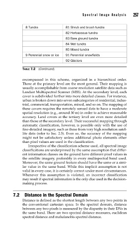
8 Tundra 81 Shrub and brush tundra
82 Herbaceous tundra
83 Bare ground tundra
84 Wet tundra
85 Mixed tundra
9 Perennial snow or ice 91 Perennial snowfields
92 Glaciers
TABLE 7.2 (Continued)
encompassed in this scheme, organized in a hierarchical order.
Those at the primary level are the most general. Their mapping is
usually accomplishable from coarse resolution satellite data such as
Landsat Multispectral Scanner (MSS). At the secondary level, each
cover is subdivided further into more detailed classes. For instance,
urban is broken down into seven subcategories of residential, indus-
trial, commercial, transportation, mixed, and so on. The mapping of
these covers requires the remotely sensed data to have a moderate
spatial resolution (e.g., around 30 m) in order to achieve reasonable
accuracy. Land covers at the tertiary level are even more detailed
than those at the secondary level. Their successful mapping through
automatic classification, however, is possible only with the use of
fine-detailed imagery, such as those from very high resolution satel-
lite data (refer to Sec. 2.5). Even so, the accuracy of the mapping
might not be satisfactory unless additional photo elements other
than pixel values are used in the classification.
Irrespective of the classification scheme used, all spectral image
classifications are underpinned by the same assumption that differ-
ent information classes on the ground have different pixel values in
the satellite imagery, preferably in every multispectral band used.
Moreover, the same ground feature should have the same or a simi-
lar value in the same band. While this implicit assumption is not
valid in every case, it is certainly correct under most circumstances.
Whenever this assumption is violated, an incorrect classification
may result if spectral information is the only clue used in the decision-
making process.
7.2 Distance in the Spectral Domain
Distance is defined as the shortest length between any two points in
the conventional cartesian space. In the spectral domain, distance
between any two pixels is measured by the disparity in their DNs in
the same band. There are two spectral distance measures, euclidean
spectral distance and mahalanobis spectral distance.