
Page 129 - Introduction to Mineral Exploration
P. 129
112 M.K.G. WHATELEY
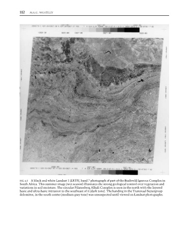
FIG. 6.5 A black and white Landsat 1 (ERTS), band 7 photograph of part of the Bushveld Igneous Complex in
South Africa. This summer image (wet season) illustrates the strong geological control over vegetation and
variations in soil moisture. The circular Pilanesberg Alkali Complex is seen in the north with the layered
basic and ultra-basic intrusion to the southeast of it (dark tone). The banding in the Transvaal Supergroup
dolomites, in the south center (medium gray tone) was unsuspected until viewed on Landsat photographs.