Page 289 - Laboratory Manual in Physical Geology
P. 289

BIG IDEAS                           PRE-LAB VIDEO

                                                                      Some of Earth’s rocky landscapes expose originally
                                                                    horizontal layers of rock that have been visibly tilted,
                                                                    fractured, dislocated, folded, or otherwise deformed into
                                                                    complex geologic structures. The structures are often too
                                                                    large to see in one place. To visualize them, geologists
                                                                    make regional geologic maps and block diagrams with
                                                                    field data assembled from many sites. The maps and
                                                                    diagrams are then used to reveal the structures and
                                                                    determine how they formed.


                                                                      FOCUS YOUR INQUIRY
                                                                         THINK
                                                                    About It  | How are deformed rocks identified and classified?
                                                                    ACTIVITY 10.1 Geologic Structures Inquiry  (p.  260 )

                                                                           |
                                                                         THINK  What kinds of stress relationships cause geologic
                                                                    About It  structures to develop?
                                                                    ACTIVITY 10.2  Visualizing How Stresses Deform
                                                                                 Rocks   (p.  260 )


                                                                           |
                                                                         THINK  How do geologists map geologic structures on
                                                                    About It  and beneath Earth’s surface?
                                                                              ACTIVITY 10.3 Map Contacts and Formations  (p.  261 )

                                                                             ACTIVITY 10.4  Determine Attitude of Rock Layers and a
                                                                                 Formation Contact   (p.  262 )

                                       10                                THINK  |  How are three-dimensional models used to

                                                                            visualize geologic structures?
                                                                    About It
                                                                    ACTIVITY 10.5  Cardboard Model Analysis and
               LA B O RA T O R Y                                                 Interpretation   (p.  263 )
                                                                    ACTIVITY 10.6  Block Diagram Analysis and
                                                                                 Interpretation   (p.  263 )
                      Geologic

                                                                         THINK  |  How do geologists define, analyze, and interpret
               Structures,                                          About It   geologic structures using images of landscapes?

                                                                    ACTIVITY 10.7  Nevada Fault Analysis Using Orthoimages
               Maps, and Block                                                   (p.  263 )

               Diagrams                                                  THINK  |  How do geologists visualize geologic structures
                                                                            using geologic maps?
                                                                    About It
                                                                              ACTIVITY 10.8  Appalachian Mountains Geologic Map
                         C ONTRIBUTING   A UTHORS                                (p.  263 )
                   Michael J. Hozik   •    Stockton College of New Jersey
                  William R. Parrott, Jr.   •    Stockton College of New Jersey
                   Raymond W. Talkington   •    Stockton College of New Jersey
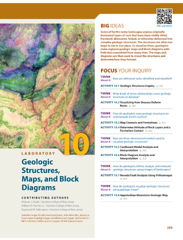
               Satellite image of deformed rock layers, Anti-Atlas Mts., Morocco.
               False colors highlight layers of different rock types. (NASA/GSFC/
               METI/ERSDAC/JAROS and U.S./Japan ASTER Science Team)
                                                                                                                 259
   284   285   286   287   288   289   290   291   292   293   294