
Page 200 - Reservoir Geomechanics
P. 200
182 Reservoir geomechanics
a.
126 127
10 10
AUSTRALIAN–INDONESIAN
CONVERGENCE DIRECTION
11 11
50 km
126 127
b.
38 240 36
238
38 200 km 240
36 238
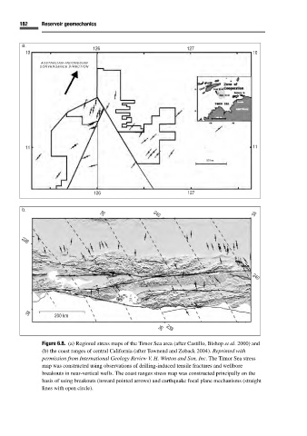
Figure 6.8. (a) Regional stress maps of the Timor Sea area (after Castillo, Bishop et al. 2000) and
(b) the coast ranges of central California (after Townend and Zoback 2004). Reprinted with
permission from International Geology Review V. H. Winton and Son, Inc. The Timor Sea stress
map was constructed using observations of drilling-induced tensile fractures and wellbore
breakouts in near-vertical wells. The coast ranges stress map was constructed principally on the
basis of using breakouts (inward pointed arrows) and earthquake focal plane mechanisms (straight
lines with open circle).