
Page 79 - Digital Analysis of Remotely Sensed Imagery
P. 79
50 Cha pte r T w o
3
Radarsat 2
Resolution (m) 2 ∗ EROS A OrbView 3 Formosat QuickBird 3
Cartosat 1 ALOS
SPOT 5
Cosmos 2
1 Resurs 1 Cartosat 2
QuickBird 2 Kompsat 2 Cosmo Pleiades
EROS B WorldView 2 EROS C
WorldView 1
GeoEye
2001 2002 2003 2004 2005 2006 2007 2008 2009 2010
Year
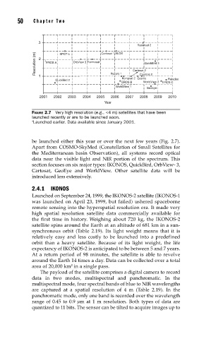
FIGURE 2.7 Very high resolution (e.g., <4 m) satellites that have been
launched recently or are to be launched soon.
∗ Launched earlier. Data available since January 2001.
be launched either this year or over the next few years (Fig. 2.7).
Apart from COSMO-SkyMed (Constellation of Small Satellites for
the Mediterranean basin Observation), all systems record optical
data near the visible light and NIR portion of the spectrum. This
section focuses on six major types: IKONOS, QuickBird, OrbView- 3,
Cartosat, GeoEye and WorldView. Other satellite data will be
introduced less extensively.
2.4.1 IKONOS
Launched on September 24, 1999, the IKONOS-2 satellite (IKONOS-1
was launched on April 23, 1999, but failed) ushered spaceborne
remote sensing into the hyperspatial resolution era. It made very
high spatial resolution satellite data commercially available for
the first time in history. Weighing about 720 kg, the IKONOS-2
satellite spins around the Earth at an altitude of 681 km in a sun-
synchronous orbit (Table 2.19). Its light weight means that it is
relatively easy and less costly to be launched into a predefined
orbit than a heavy satellite. Because of its light weight, the life
expectancy of IKONOS-2 is anticipated to be between 5 and 7 years.
At a return period of 98 minutes, the satellite is able to revolve
around the Earth 14 times a day. Data can be collected over a total
area of 20,000 km in a single pass.
2
The payload of the satellite comprises a digital camera to record
data in two modes, multispectral and panchromatic. In the
multispectral mode, four spectral bands of blue to NIR wavelengths
are captured at a spatial resolution of 4 m (Table 2.19). In the
panchromatic mode, only one band is recorded over the wavelength
range of 0.45 to 0.9 μm at 1 m resolution. Both types of data are
quantized to 11 bits. The sensor can be tilted to acquire images up to