
Page 209 - Geochemical Anomaly and Mineral Prospectivity Mapping in GIS
P. 209
Knowledge-Driven Modeling of Mineral Prospectivity 211
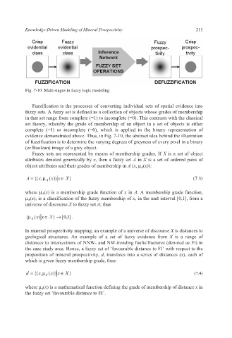
Fig. 7-10. Main stages in fuzzy logic modeling.
Fuzzification is the processes of converting individual sets of spatial evidence into
fuzzy sets. A fuzzy set is defined as a collection of objects whose grades of membership
in that set range from complete (=1) to incomplete (=0). This contrasts with the classical
set theory, whereby the grade of membership of an object in a set of objects is either
complete (=1) or incomplete (=0), which is applied in the binary representation of
evidence demonstrated above. Thus, in Fig. 7-10, the abstract idea behind the illustration
of fuzzification is to determine the varying degrees of greyness of every pixel in a binary
(or Boolean) image of a grey object.
Fuzzy sets are represented by means of membership grades. If X is a set of object
attributes denoted generically by x, then a fuzzy set A in X is a set of ordered pairs of
object attributes and their grades of membership in A (x, μ A(x)):
A = {(x ,μ A (x )) x ∈ X } (7.3)
where μ A(x) is a membership grade function of x in A. A membership grade function,
μ A(x), is a classification of the fuzzy membership of x, in the unit interval [0,1], from a
universe of discourse X to fuzzy set A; thus
{μ A (x ) ∈ X } → ] 1 , 0 [ .
x
In mineral prospectivity mapping, an example of a universe of discourse X is distances to
geological structures. An example of a set of fuzzy evidence from X is a range of
distances to intersections of NNW- and NW-trending faults/fractures (denoted as FI) in
the case study area. Hence, a fuzzy set of ‘favourable distance to FI’ with respect to the
proposition of mineral prospectivity, d, translates into a series of distances (x), each of
which is given fuzzy membership grade, thus:
d = {(x ,μ d (x )) x ∈ X } (7.4)
where μ d(x) is a mathematical function defining the grade of membership of distance x in
the fuzzy set ‘favourable distance to FI’.