
Page 262 - Laboratory Manual in Physical Geology
P. 262
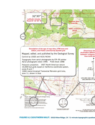
and year photorevised (1974)
                                                         year published (1958),
                                                       Name of quadrangle,
                                                                   Directional data including declination (difference in degrees) between compass north (MN) and true north (star symbol)  Map  location  Public Land  Survey  System  range  boundary  Map ratio scale,  bar scales, and  contour interval (Southern half of map reduced to about 55% of its actual size) (Courtesy of USGS)        –minute topographic quadrangle map.


                             Contour lines  (narrow)  Index contours  (bold)

                                                                                                                                                        USGS Ritter Ridge, CA 7.5


                                                                  datum, and Public Land Survey System grid


                          Latitude minutes  Read 34° 32' 00" N  Description of the age of map data, UTM zone and                                        FIGURE 9.3 (SOUTHERN HALF)