
Page 19 - Sumatra Geology, Resources and Tectonic Evolution
P. 19
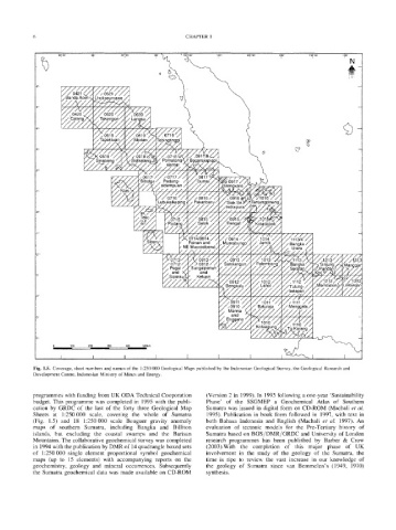
6                                                 CHAPTER  1


                                                                                                      106<'30 ,
                                                                                                       I


                     r./i/o:  d    o
                                  ........
                     [/Banda  Aceh ~  Lhokseumawe
                           ......" /".
                       ,,  ,.
                     VZZZEZA
                     i~".._o4. 2o U./;
                                                                                                                 <b
                                                    "rebingt!pggi' I
                                                    ;                                            t7
                                           /Sidikafang,  ~,/Pematan(   " Bagansiapiapi
                                            "  ~'(///"/~   /   siantar"   ." ./c-~/./'//./'


                                                       Padang-
                                                     sidempuan


                                                             NE Muarasiberut

                                                                           ., 0913  /  ..."
                                                               Sungaipenuh'
                                                                  and
                                                                 Ketuan


             6'-                                                                   ~      "   '  "  t  "  ~   ~   ~ "  -~,.%.f~
                  t3    1 O0   200   300 .................   400   500kin                     %'7   /


            Fig.  1.5.  Coverage,  sheet numbers and names of the  1:250 000 Geological  Maps published by  the Indonesian Geological Survey, the Geological  Research and
            Development Centre, Indonesian Ministry of Mines and Energy.


            programmes with funding from UK ODA Technical Cooporation   (Version 2 in  1999).  In  1995 following a one-year  'Sustainability
            budget.  This programme  was  completed  in  1995 with the  publi-   Phase'  of  the  SSGMEP  a  Geochemical  Atlas  of  Southern
            cation  by  GRDC  of  the  last  of  the  forty  three  Geological  Map   Sumatra  was issued in digital form  on  CD-ROM  (Machali et  al.
            Sheets  at  1:250000  scale,  covering  the  whole  of  Sumatra   1995).  Publication in  book  form  followed  in  1997,  with  text  in
            (Fig.  1.5)  and  18  1:250000  scale  Bouguer  gravity  anomaly   both  Bahasa  Indonesia  and  English  (Machali  et  al.  1997). An
            maps  of  southern  Sumatra,  including  Bangka  and  Billiton   evaluation  of  tectonic  models  for  the  Pre-Tertiary  history  of
            islands,  but  excluding  the  coastal  swamps  and  the  Barisan   Sumatra based on BGS/DMR/GRDC  and University of London
            Mountains. The collaborative geochemical survey was completed   research  programmes  has  been  published  by  Barber  &  Crow
            in 1994 with the publication by DMR of 14 quadrangle boxed sets   (2003).With  the  completion  of  this  major  phase  of  UK
            of  1:250 000  single  element  proportional  symbol  geochemical   involvement  in  the  study  of  the  geology  of  the  Sumatra,  the
            maps  (up  to  15  elements)  with  accompanying  reports  on  the   time  is  ripe  to  review  the  vast  increase  in  our  knowledge  of
            geochemistry,  geology  and  mineral  occurrences.  Subsequently   the  geology  of  Sumatra  since  van  Bemmelen's  (1949,  1970)
            the  Sumatra  geochemical data  was  made  available on  CD-ROM   synthesis.