
Page 100 - Geochemical Anomaly and Mineral Prospectivity Mapping in GIS
P. 100
Fractal Analysis of Geochemical Anomalies 99
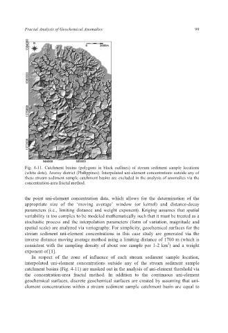
Fig. 4-11. Catchment basins (polygons in black outlines) of stream sediment sample locations
(white dots), Aroroy district (Philippines). Interpolated uni-element concentrations outside any of
these stream sediment sample catchment basins are excluded in the analysis of anomalies via the
concentration-area fractal method.
the point uni-element concentration data, which allows for the determination of the
appropriate size of the ‘moving average’ window (or kernel) and distance-decay
parameters (i.e., limiting distance and weight exponent). Kriging assumes that spatial
variability is too complex to be modeled mathematically such that it must be treated as a
stochastic process and the interpolation parameters (form of variation, magnitude and
spatial scale) are analyzed via variography. For simplicity, geochemical surfaces for the
stream sediment uni-element concentrations in this case study are generated via the
inverse distance moving average method using a limiting distance of 1700 m (which is
2
consistent with the sampling density of about one sample per 1-2 km ) and a weight
exponent of [1].
In respect of the zone of influence of each stream sediment sample location,
interpolated uni-element concentrations outside any of the stream sediment sample
catchment basins (Fig. 4-11) are masked out in the analysis of uni-element threshold via
the concentration-area fractal method. In addition to the continuous uni-element
geochemical surfaces, discrete geochemical surfaces are created by assuming that uni-
element concentrations within a stream sediment sample catchment basin are equal to