
Page 269 - Laboratory Manual in Physical Geology
P. 269
Land Management (BLM) regulates and maintains public these are shown on topographic quadrangle maps, like the
land using the PLSS. It is also used as the basis for many red-brown grid of square numbered sections in FIGURE 9.3 .
legal surveys of private land that was once publicly owned. Any tiny area or point can be located precisely within a sec-
tion by dividing the section into quarters ( labeled NW, NE,
PLSS Township-and-Range Grids SW, SE). Each of these quarters can itself be subdivided into
The PLSS is a square grid system centered on any one of doz- quarters and labeled ( FIGURE 9.8C ).
ens of principal meridians (lines running north and south)
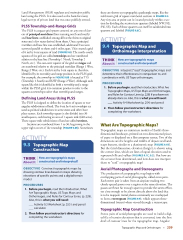
and base lines established among all but the thirteen original ACTIVITY
states and a few states derived from them. Once a principal
meridian and base line was established, additional lines were 9.4 Topographic Map and
surveyed parallel to them and 6 miles apart. This created a grid
of 6 mi by 6 mi squares of land ( FIGURE 9.8 ). The north–south Orthoimage Interpretation
squares of the grid are called townships and are numbered
relative to the base line (Township 1 North, Township 2 THINK | How are topographic maps
North, etc.). The east–west squares of the grid are ranges and About It constructed and interpreted?
are numbered relative to the principal meridian (Range 1 West,
Range 2 West, etc.). Each 6 mi by 6 mi square is, therefore, OBJECTIVE Interpret (“read”) topographic maps and
identified by its township and range position in the PLSS grid. determine their effectiveness in comparison to, and
For example, the township in FIGURE 9.8B is located at T1S combination with, US Topo orthoimages.
(Township 1 South) and R2W (Range 2 West). Although each
square like this is identified as both a township and a range PROCEDURES
within the PLSS grid, it is common practice to refer to the 1. Before you begin , read the Introduction, What Are
squares as townships rather than township-and-ranges. Topographic Maps, US Topo Maps and Orthoimages,
and Rules for Contour Lines (p. 228) if you have not
Defining Land Areas Using PLSS already done so. Also, this is what you will need :
The PLSS is designed to define the location of square or rect- ___ Activity 9.4 Worksheet (p. 254 ) and pencil
angular subdivisions of land. The 6 mi by 6 mi townships are 2. Then follow your instructor’s directions for
used as political subdivisions in some states and often have completing the worksheet.
place names. Each township square is also divided into 36
small squares, each having an area of 1 square mile (640 acres).
These square-mile subdivisions of land are called sections .
Sections are numbered from 1 to 36, beginning in the What Are Topographic Maps?
upper right corner of the township ( FIGURE 9.8B ). Sometimes
Topographic maps are miniature models of Earth’s three-
dimensional landscape, printed on two-dimensional pieces
ACTIVITY of paper or displayed on a flat computer screen. Two of the
dimensions are the lengths and widths of objects and land-
9.3 Topographic Map scape features, similar to a planimetric map ( FIGURE 9.1B ).
Construction But the third dimension, elevation (height), is shown using
the contour lines , which are lines of equal elevation used to
represent hills and valleys ( FIGURES 9.1C , 9.3 ). But how are
THINK | How are topographic maps the contour lines determined, and how does one interpret
About It constructed and interpreted? them to “read” a topographic map?
OBJECTIVE Construct topographic maps by Aerial Photographs and Stereograms
drawing contour lines based on maps showing The production of a topographic map begins with
elevations of specific points and a digital terrain overlapping pairs of aerial photographs, called stereo pairs .
model.
Each stereo pair is taken from an airplane making two
PROCEDURES closely spaced passes over a region at the same elevation. The
passes are flown far enough apart to provide the stereo effect,
1. Before you begin , read the Introduction, What
Are Topographic Maps, US Topo Maps and yet close enough to be almost directly above the land that
Orthoimages, and Rules for Contour Lines, (p. 228). is to be mapped. Aerial photos commonly are overlapped
Also, this is what you will need : to form a stereogram ( FIGURE 9.9 ), which appears three-
dimensional (stereo) when viewed through a stereoscope.
___ Activity 9.3 Worksheet (p. 253 ) and pencil
___ calculator
Topographic Map Construction
2. Then follow your instructor’s directions for Stereo pairs of aerial photographs are used to build a digi-
completing the worksheet. tal file of terrain elevations that is converted into the first
draft of contour lines for the topographic map. Angular
Topographic Maps and Orthoimages ■ 239